

Thunderstorm risk tomorrow before our biggest warm up so far this year kicks in!

April 2017
Conditions were cooler and wetter than normal during April 2017 in Saskatoon.
Overall temperatures trended 0.6 degrees cooler than normal with an average temperature of 4.1 degrees when the normal is 4.7 degrees.

Most of the coolness was felt on the daytime high side of things, which averaged out almost a degree colder than normal with overnight lows much closer to seasonal values, only 0.2 degrees cooler.
Precipitation-wise the city saw 119 per cent of our normal precipitation with a total of 18.4 millimetres of rain, melted snow and other types of precipitation throughout the month, when normally we receive 15.5 millimetres.
Saskatoon Forecast
Today
Five hours of light rain started the day in Saskatoon as a low pressure system spun by with cloudy skies helping to keep us fairly mild with temperatures only dropping to 6 degrees this morning.
We warmed up toward double digits late morning with a northerly wind breezy at times keeping conditions cooler today.
Clouds are expected to eventually clear out during the afternoon as we climb up to a daytime high in low double digits.

Get daily National news
Tonight
Mostly clear skies will stick around tonight as we cool back toward the freezing mark.
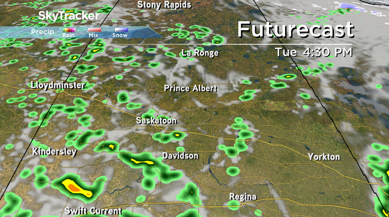
Tuesday
We’ll see some sunshine early in the day on Tuesday but we’ll also be sitting in an unstable airmass during the day, so with daytime heating and an upper disturbance moving through, clouds will bubble up by afternoon and bring in a good chance of showers or thunderstorms later on.
Temperatures will be a bit warmer than on Monday with an afternoon high in the mid-teens expected.


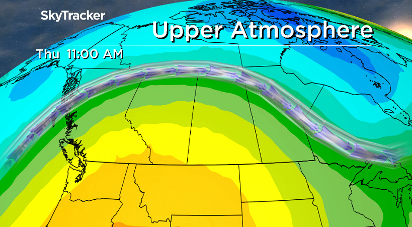
Wednesday-Friday
A massive upper ridge of high pressure takes hold for the rest of the week, which will help kick out the cloud and bring us into our biggest warm up yet this year!
As the mild air pushes in we may see some cloud cover build in Wednesday afternoon, but we’ll be otherwise mostly sunny with daytime highs pushing from mid-teens Wednesday to mid 20s by Friday.
Weekend Outlook
The question now is how long will the upper ridge hold?
Models are in agreement that it should hold for Saturday with a daytime high in the mid-to-high 20s with some sunshine, but there are some that are bringing in a cold front, cloud and a chance of showers on Sunday, which would drop our daytime high that day into the low 20s.
We’ll keep an eye on the situation and keep you posted with the latest as the date approaches.

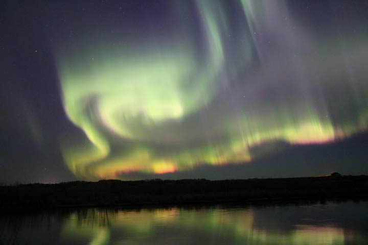
This Your Saskatchewan photo was taken by Paige Ziprick near Borden:
Saskatoon weather outlook is your source for Saskatoon’s most accurate forecast and is your one stop shop for all things weather for central and northern Saskatchewan with comprehensive, in-depth analysis that you can only find here.
Comments
Want to discuss? Please read our Commenting Policy first.