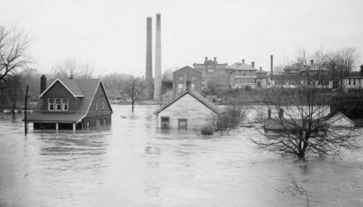
Five people were killed and more than 1,000 homes were destroyed when the Thames River rose a record 23 feet in the city, 80 years ago Wednesday.

According to the Upper Thames River Conservation Authority (UTRCA), April 26 marks the 80th anniversary of the Flood of 1937, the largest flood recorded on the Thames River.
The event caused approximately $3 million worth of damage, or about $51 million when adjusted for inflation.
“The 1937 flood is actually the standard that we use to define flood hazards and the area in which development is regulated,” Tasker said.
A decade after the flood, the UTRCA was formed in 1947. According to the organization, their three guiding principles are:


- Cost sharing between the province and local municipalities
- Conservation authority boundaries based upon geographical watersheds, not political boundaries
- Decisions made locally by a board of directors appointed by watershed municipalities
According to Tasker, the organization started on infrastructure in the Ingersoll channel to protect the area and industrial areas.
In 1952, the Fanshawe Dam, the first flood control dam to be built on the Thames watershed, was constructed to help reduce flood damages to the city.
The organization currently has a network of more than 30 stream gauges for flood forecasting and warning, three major dams – Wildwood, Pittock and Fanshawe – as well as a series of dykes, flood walls, and channels throughout the watershed for flood management.
Comments