



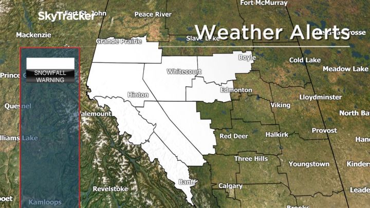
An Environment Canada snowfall warning continued for some parts of west Alberta Saturday, while the warning ended for sections in the central area of the province.

The weather agency initially issued the warnings for west and central Alberta at around 8:45 p.m. Friday.
According to the weather agency, snowfall accumulations were generally forecast to be between 10 to 15 cm by Saturday evening.
As of 4:00 p.m. on Saturday, the following areas were under a snowfall warning:
- Banff National Park
- Jasper National Park
- Kananaskis – Canmore
- Nordegg – Forestry Trunk Road Highway 734

Get breaking National news
Watch below: Margeaux Morin has an update on snowfall warnings issued for parts of central and western Alberta on Friday.

- Storm to bring up to 60 millimetres of rain to parts of Ontario, Quebec
- A ferocious Hurricane Simon nears Mexico with 155 mph winds and flooding fears
- Simon strengthens into a Category 4 hurricane as it approaches Mexico’s coast
- Isaias weakens but flash flooding threat persist as hundred of thousands grapple with power outages


The warning ended for the areas of Hinton – Grande Cache, Okotoks – High River – Claresholm, Rocky Mountain House – Caroline, Spruce Grove – Morinville – Mayerthorpe – Evansburg, Westlock – Barrhead – Athabasca, and Whitecourt – Edson – Fox Creek – Swan Hills.
Snowfall warnings are issued when snowfall accumulations of 10 cm or more are expected in 12 hours or less.
For the latest on Environment Canada’s weather warnings in Alberta, click here.
To report severe weather to Environment Canada, you can send an email to ec.storm.ec@canada.ca or tweet reports to #ABStorm.
Want your weather on the go? Download the Global News Skytracker app for iPhone, iPad and Android.


Comments
Want to discuss? Please read our Commenting Policy first.