
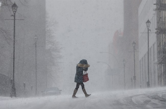
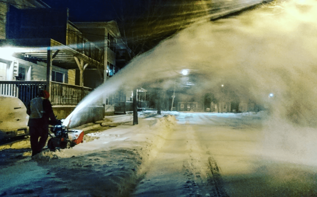
A huge, slow-moving low pressure system cut through southern Ontario and Quebec Sunday night, forcing Environment Canada to issue storm warnings right through to the Maritimes for Monday.

The agency warned of up to 60 centimeters of snow for some regions, with winds up to 100 km/h expected to cause white-out conditions.
Areas like Halifax are still trying to recover after seeing some form of precipitation almost every day since Dec. 7, 2016. There have only been four days since early December without rain or snow in that city.
Ahead of this latest storm, towns and cities across New Brunswick set new record low temperatures for Feb. 12.
READ MORE: ‘Hazardous winter conditions’ expected for Nova Scotia, New Brunswick

Get breaking National news
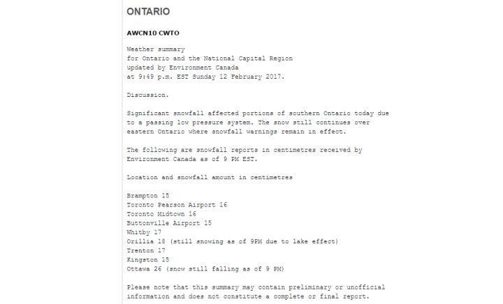
As of 9 p.m. EST Sunday, Toronto saw around 16 centimetres of snow from that low pressure system. As of 12 a.m. Monday, Ottawa recorded 28 centimetres of snow.


WestJet started warning travelers Saturday to expect delays until possibly Tuesday.
For a look at the latest weather warnings click here.
Want your weather on the go? Download Global News’ Skytracker weather app for iPhone, iPad and Android.
- Alberta Next panel report calls to ditch RCMP, hold referendum to quit CPP
- Alberta minister, new permanent chief medical officer of health eye renewed collaboration
- Former UCP member unveils new ‘Progressive Tory Party of Alberta’ name
- Cause of explosion at Taber ice rink under investigation, cleanup underway


Comments