

WINNIPEG — It was a weekend to forget – weather wise that is.

A mix of rain, wind and cool temperatures plagued the Thanksgiving long weekend – and it’s not getting any better.
At least not until the end of the week.
Our normal daytime high for this time of year is still quite pleasant and still in double digits sitting at 11 Celsius.

Get daily National news
Get daily Canada news delivered to your inbox so you'll never miss the day's top stories.
By providing your email address, you have read and agree to Global News' Terms and Conditions and Privacy Policy.
We’ll see nothing close to that until we get much later in the week, and into the weekend.
A few nights of below freezing temperatures are also to be expected.
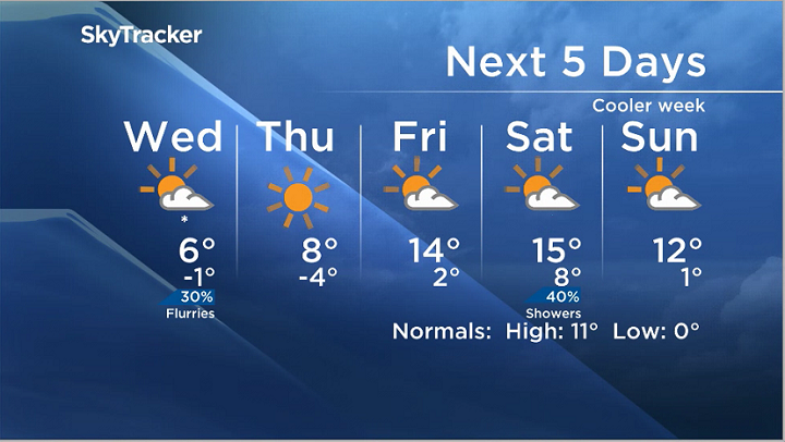


Flurries, a chance of them anyway sit in the forecast for Wednesday and we could still see some showers roll through.
The long range model suggests that we could see normal or above normal temperatures into next week.
Comments
Want to discuss? Please read our Commenting Policy first.