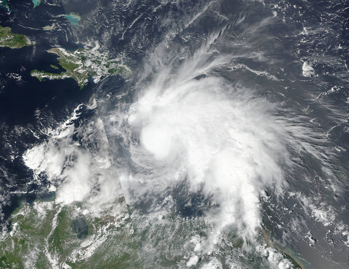
KINGSTON, Jamaica – Hurricane Matthew grew into a powerful Category 3 storm on Friday as it crossed the Caribbean Sea on a course that could have it pounding Jamaica within days.

The centre of the hurricane was projected to pass just to the east of Jamaica early Monday, but the storm was large enough that it could affect the entire island, and the first effects of the storm may be felt starting Saturday, said Evan Thompson, director of the National Meteorological Service.

Get daily National news
Jamaica activated its National Emergency Operations Center and Prime Minister Andrew Holness called an urgent meeting of Parliament to discuss preparations for the storm.
Parts of the country, especially the eastern tip and higher elevations, could get up to 8 inches (20 centimetres) of rain. Flooding and some landslides are likely. “We do consider it serious,” Thompson said. “We are all on high alert.”
The capital, Kingston, is in the southeastern corner of Jamaica and was expected to experience flooding.
As of 11 a.m. EDT (1500 GMT), the storm was centred about 495 miles (800 kilometres) southeast of Kingston and had maximum sustained winds of 115 mph (185 kmh), according to the U.S. National Hurricane Center in Miami.
Hurricane-force winds extended outward up to 35 miles (55 kilometres) from the centre and tropical-storm-force winds extend outward up to 195 miles (315 kilometres).
Matthew caused at least one death when it entered the Caribbean on Wednesday, with officials in St. Vincent reporting a 16-year-old boy was crushed by a boulder as he tried to clear a blocked drain.


Comments