

A warm start to the weekend before a cold front slides through dropping Saskatoon’s temperatures back for the final few days of summer.

Saskatoon Forecast
Today
Clear skies last night allowed temperatures to drop down to 3 degrees overnight.
A narrow ridge of high pressure over our area kept skies clear and sunny this morning with a south-southwesterly wind also helping boost the mercury up into the 20s by 11 a.m. CT.
This afternoon, we’re shooting for the mid-20s under a continuation of mostly sunny skies.
Tonight
It’ll be another clear night great for stargazing with temperatures dipping back into single digits with an overnight low a bit warmer around 7 degrees thanks, in part, to a moderate 20 to 30 km/h southerly wind and a low pressure system moving into Alberta.
Saturday

Get daily National news
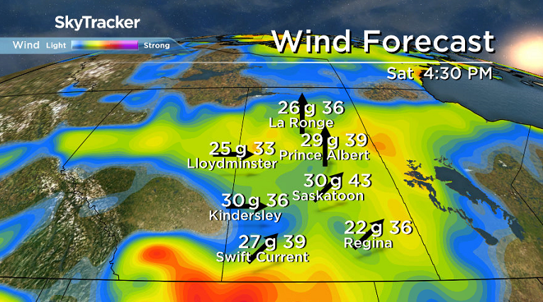
That low pressure system will give us a warm Saturday as it keeps us in the mild sector of the system through the day with a breezy southwesterly wind at sustained speeds between 20 to 30 km/h with gusts upwards of 40 km/h.
The day will start out sunny tomorrow, but clouds will build in with the approach of a surface trough, upper disturbance and moisture pulse that’ll keep us in the clouds throughout much of the afternoon.
That being said, we still should hit a daytime high in the mid-20s, making for a glorious start to the weekend.
There may be some late afternoon clearing before another batch of clouds moves in for the evening.
Sunday
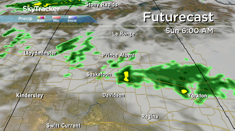
Sunday will be a very different day than Saturday with much more in the way of clouds and a good chance of rain through the day as a cold front slides through (rain is timed out in the video above).


Winds will switch around to be from the west-northwest at sustained speeds around 30 km/h with gusts upwards of 40 to 50 km/h.
Temperatures will also take a hit behind the front, with an expected high in the upper teens.
Work Week Outlook
Despite mostly sunny skies expected Monday, being behind Sunday’s cold front will do its damage, keeping us out of the 20s and in the upper teens.
That temperature trend will continue on Tuesday with clouds building back in during the day.
Those clouds are part of a system passing by south of the city that’ll bring with it a chance of rain Wednesday into early Thursday and keep us under mostly cloudy skies.
Daytime highs will then push back even further into the mid-teens both for the final day of summer on Wednesday into the first day of autumn on Thursday.
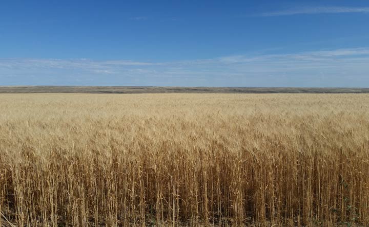
This Your Saskatchewan photo was taken by Juliana Marques in Grasslands National Park:
Saskatoon weather outlook is your one stop shop for all things weather for Saskatoon, central and northern Saskatchewan with a comprehensive look at your local forecast that you can only find here.
Comments
Want to discuss? Please read our Commenting Policy first.