


A good chance of frost as temperatures could fall below freezing in Saskatoon’s forecast.

Saskatoon Forecast
Today
A few light rain showers started the day in Saskatoon under mostly cloudy skies and temperatures around eight degrees.
Heavier pockets of rain are in the forecast today for portions of east-central Saskatchewan with anywhere from five to 30 millimetres possible.
Light rain continued off and on through the morning, putting a damper on temperatures, keeping them in low double digits through late morning.
This afternoon we’re expecting the cloud cover to stick around and the rain will become less frequent with a few pockets still likely to move through at times as the mercury attempts to climb into the high teens.

Get daily National news
Tonight
By the overnight period, only a few clouds look like they’ll be left lingering over the region as temperatures dip back to around five degrees.
Thursday
Tomorrow may start off with some sunshine early in the day, but the clouds will build back in during the morning as an upper low swings by south of the city and brings in a good chance of midday showers lingering right into the later portion of the day.
The rain will once again keep conditions a bit cooler through the day with an afternoon high hoping to make it up to around 18 degrees, depending on the timing of the showers.
Friday
Partly to mostly cloudy skies with a slight chance of showers is expected on Friday with temperatures remaining a degree or so cooler in the afternoon and an unsettled northwesterly flow continues aloft.
Weekend
We finally get into some upper level ridging on Saturday that’ll help boost temperatures back up into the low 20s under partly to mostly cloudy skies once again.


The bout of heat will be brief though – Sunday marks a return to the cool, unsettled weather as a cold front slides through bringing with it a good chance of rain and pushing our daytime high back into the mid-teens.
Work Week Outlook
Behind Sunday’s cold front will be much cooler temperatures under mostly cloudy skies for Monday and a daytime high in low double digits.
Even further cooling is expected into Tuesday as clouds clear out of the region.
It looks like temperatures could fall down to the freezing mark with a good chance of frost both Tuesday and Wednesday.
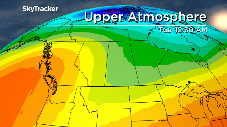
Some forecast models are bringing in morning lows below 0 next week, so we will keep a close eye on the situation and bring you the latest updates as the date approaches.
This Your Saskatchewan photo was snapped near Turtleford in the R.M. of Mervin by Gerald Olson:

Saskatoon weather outlook is your one stop shop for all things weather for Saskatoon, central and northern Saskatchewan with a comprehensive, detailed look at your local forecast that you can only find here.


Comments
Want to discuss? Please read our Commenting Policy first.