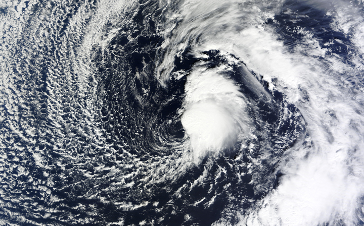
The U.S. National Weather Service and NASA are keeping an eye on a low-pressure system in the North Atlantic Ocean that has the possibility of becoming a subtropical or tropical system over the next few days.

The disturbance is located about 1,400 km northwest of the Azores and is producing gale-force winds near 95 km/h, with hurricane-strength gusts. It is only producing rain near the core.
READ MORE: First of several storms spawned by El Nino hitting California
The National Hurricane Center in Miami, Fla., said that the storm has a 40 per cent of developing into a tropical storm within the next 48 hours.
Should the storm develop into a tropical storm, it would be rare, but not unheard of. The last such was Tropical Storm Zeta, which developed on Dec. 30, 2005 and lasted until Jan. 7, 2006. In total, there have only been two tropical storms to have developed in January since 1851.
Should this storm develop into a hurricane, it would only be the second January hurricane since 1851.
Meanwhile, another rare tropical storm is churning — this time in the Pacific Ocean.
Hurricane Pali developed last week and is continuing strong. On Jan. 10, Pali became the earliest hurricane on record in the Central Pacific. The storm is producing maximum sustained winds of 150 km/h, making it a Category 1 on the Saffir-Simpson Scale.
The storm is expected to continue moving south at seven km/h before turning southwest on Thursday morning.
- Trudeau says ‘good luck’ to Saskatchewan premier in carbon price spat
- Canadians more likely to eat food past best-before date. What are the risks?
- Hundreds mourn 16-year-old Halifax homicide victim: ‘The youth are feeling it’
- On the ‘frontline’: Toronto-area residents hiring security firms to fight auto theft


Comments