
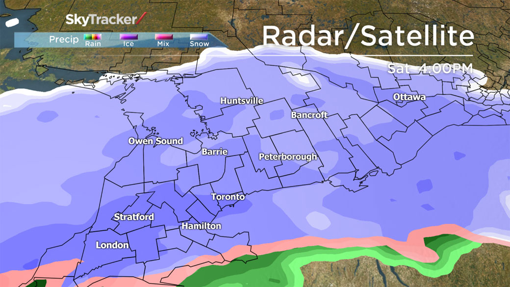
TORONTO – Though it looks like Toronto may escape the weekend’s heaviest snowfall, Environment Canada has issued a snowfall warning for areas around the city.

The warning extends from Huron County east to eastern Ontario and includes, Durham, York, Caledon and extends north to Barrie and Orillia. It also includes Ottawa and eastern Ontario.
A low pressure system is moving into the area and is expected to drop about 15 cm of snow on Saturday.

Get breaking National news
READ MORE: Greater Toronto Area to face snow, rain mix
The snow will start moving into southwestern Ontario by Saturday morning. But south of a line from Sarnia through to Markham towards Kingston, the snow — which is expected to be around 5 to 10 cm — will change to rain with a risk of freezing rain. Toronto can expect about 10 cm of snow.


The rain will then change back to snow late Saturday night.
Motorists are urged to use caution and drive for the road conditions as they may be quite slippery.
For more info on Toronto weather, visit our Skytracker page.
Comments
Want to discuss? Please read our Commenting Policy first.