


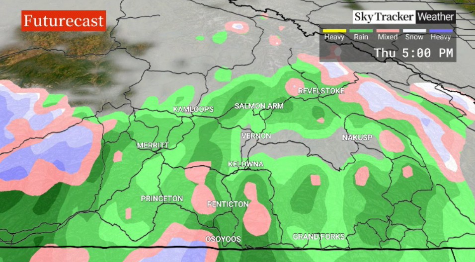
Fog returned to the Okanagan on Monday, making room for afternoon clouds and temperatures in the upper single digits.

Clouds will roll back in on Tuesday along with a chance of late-day showers with similar temperatures as a subtropical moisture feed slams into the coast and spreads a few pockets of moisture into the Interior.
There will be mostly cloudy skies through the remainder of the week as January ends Wednesday and February kicks off Thursday with a chance of showers into the new month.

Get daily National news
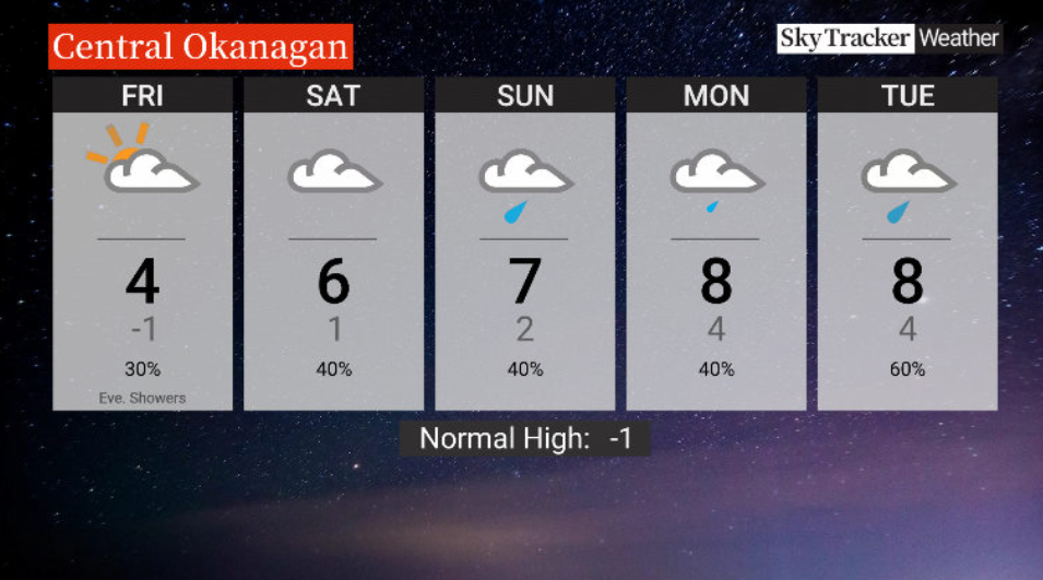
Overnight lows will remain above freezing with daytime highs in mid-to-upper single digits, further melting the remaining valley bottom snow.
The first weekend of February will gradually cool down with daytime highs approaching the freezing mark.
- Record slow hurricane season, but Maritimers warned to stay vigilant about extreme weather
- Tornado confirmed in Winnipeg neighbourhood, another west of the city
- ‘A lot of work ahead’: Storm-ravaged Saskatchewan cities continue cleanup
- ‘Warzone’: Storm rips through Winnipeg leaves thousands without power


For weather on the go download the Global News SkyTracker Weather App for iPhone, iPad or Android.


Comments
Want to discuss? Please read our Commenting Policy first.