
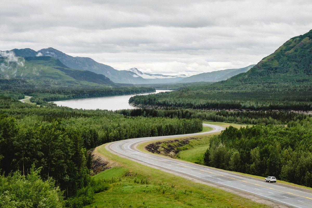

If you’re looking for an epic adventure that brings together untamed wilderness and rich history, the Alaska Highway is sure to take you on the ride of your life.

The 2,237-kilometre highway was built in nine months during the Second World War and is celebrating its 75th anniversary this year. The popular route begins in Dawson Creek, B.C., travels northwesterly through Yukon and officially ends at Delta Junction, Alaska, passing by provincial parks, over mountain summits and though communities that are intrinsically tied to one of the greatest engineering feats of the century.

“The landscape is incredibly special,” says April Moi, industry development and travel trade specialist at Northern BC Tourism, who has travelled the route several times. “When you drive it, if you put yourself in the boots of the soldiers that constructed the route, you’ll be in awe of the amazing feat it was to cut the road out of the wilderness.”
“The 75th anniversary is a great reason to consider going on this bucket-list trip,” adds Janice Fraser of Destination BC. “Northeastern British Columbia is one of the largest untouched tracts of wilderness not only in Canada, but in the world. Encountering wildlife like caribou and moose and being able to experience the vastness of our province is really what makes this trip special.”

From the bombing that set off the development of the Alaska Highway to the bison that call it home, here are 10 interesting facts about the route that changed the north forever.
The Japanese bombing of Pearl Harbor kicked off construction of the highway
As far back as the 1920s, the American and Canadian governments were in talks to build a highway connecting Alaska to the continental United States. But after the Japanese bombed Pearl Harbor on Dec. 7, 1941, the need for a road to the remote territory was urgent. Alaska was vulnerable and a highway was needed to transport supplies and troops. Canada agreed to the highway on the conditions that the United States would cover the cost and turn over the road to Canada following the war.
It was the toughest and most expensive construction project of the Second World War
The United States committed more than 11,000 soldiers and engineers, 16,000 civilians and 7,000 pieces of equipment to build the highway, which was called the hardest job since the Panama Canal. An employment ad for working on the road read: “This is no picnic. … Men hired for this job will be required to work and live under the most extreme conditions imaginable.” The final cost was about $140 million (U.S.), making it the most expensive construction project of the Second World War.
It was dubbed “the road to civil rights”
When the U.S. Army Corps of Engineers assigned more than 10,000 to build the highway in 1942, about a third of them were African-American. The army was still segregated at the time, and these black soldiers had to endure rampant racism in addition to the adverse conditions.
Nevertheless, they pushed on and their achievements became a defining moment in race relations in the United States. When the official ribbon cutting took place at Soldiers Summit, two of the four soldiers who held the ribbon were African-American. Historians say the Alaska Highway played a role in ending racial discrimination and segregation in the armed forces, which was made official with an executive order issued in 1948. Just recently, a bill designating Oct. 25 as African American Soldiers’ Contribution to Building the Alaska Highway Day was signed into law.
North America’s longest curved wooden bridge was part of the original highway
Located 30 kilometres north of Dawson Creek near the Kiskatinaw Provincial Park, you’ll find the first curved wooden bridge ever built in Canada and the only timber structure built for the Alaska Highway that’s still in use today. The impressive nine-degree curve of the Kiskatinaw Bridge was necessary to get around the steep grade on one side and the cliff on the other. With the development of the oil and gas industry came the need for a new bridge that could accommodate wider vehicles and heavier loads, so the highway was rerouted in 1978, bypassing the bridge.
However, the structure still stands and is a popular tourist destination. Visitors to the Alaska Highway House in Dawson Creek can also admire a replica of the Kiskatinaw.

Canada’s second largest hot springs are along the route
You can relax your muscles after a long day on the road with a dip in the Liard River Hot Springs, surrounded by boreal spruce forest. Located within the Liard River Hot Springs Provincial Park, the facilities include a boardwalk to the hot springs, a change area and a campground. The hot springs were once known as the Tropical Valley and used by First Nations as a place of cleansing. During the construction of the highway, the hot springs were developed for use by the soldiers and were known as the Theresa Hot Springs. And humans aren’t the only ones enjoying the warm waters: if you’re lucky, you may see a moose feeding in the warm water swamps. When you head back on the road heading north, you may also pass by some bison.

It’s home to an archeological site that contained some of the oldest human remains in Western Canada
Archeology buffs will be familiar with Charlie Lake Cave, or Tse’K’wa, where some of the oldest human remains in Western Canada were found more than three decades ago. It is also the only site in Canada where fluted point tools and associated animal remains have been found undisturbed. The evidence suggests humans lived in Northern B.C. as far back as the end of the last ice age. Please note the site is not open to visitors; special permission is required.
It’s home to one of the largest collections of signposts
You know you’re out of British Columbia when you hit Watson Lake —and you can’t miss it. The Yukon town is famous for its so-called “Sign Post Forest,” an ever-growing collection of more than 72,000 community signs brought there by people from all over the world. The tradition started when the highway was being built and homesick soldier Carl Lindley decided to add a sign for his hometown of Danville, Ill., when he was repairing the town’s directional post.
Speaking of unique collections, if you stop by the Toad River Lodge at Mile 422, you can add a baseball cap to the collection that adorns the ceiling of the dining room.
It’s one of the only places to spot Stone’s Sheep

From mountain goats and moose to beavers and bison, there’s plenty of wildlife to see along the Alaska Highway. While many of these species can be viewed in other regions, Northern B.C. and southern Alaska are the only places you can spot Stone’s Sheep. The building of the highway took a toll on the sheep, greatly reducing their numbers, but they have since recovered. Heading into the alpine of Muncho Lake Provincial Park for a hike will give you the best chance of seeing the sheep, but they can also be seen on the highway itself licking salt off the road.
It’s been nominated as a National Historic Site of Canada
In October 2015, the Alaska Highway Community Society in B.C. and the Alaska Highway Heritage Society in Yukon nominated the highway as a National Historic Site. The designation would help recognize the highway as one of North America’s most historical routes and as an important part of our history and heritage. The nomination has been endorsed by MLAs in B.C. and Yukon.
Bathrooms are not just for customers
Wondering where you’re going to use the washroom on this long journey? Facilities may be lacking, but luckily the Northern Rockies Regional Municipality has arrangements with lodge owners along the route to reimburse them for the public’s use of the washroom.

Once you’ve pulled over, you may be tempted to buy some tasty homemade baked goods to get you through the next few miles.