

Nearly 12 years to the day after intense winds ravaged Vancouver’s Stanely Park, another powerful Pacific windstorm is set to hit the region.

A wind warning is in effect for Metro Vancouver, with sustained winds of 40 to 60 kilometres per hour expected to batter some areas earlier in the day and gusts peaking at 70 kilometres per hour.
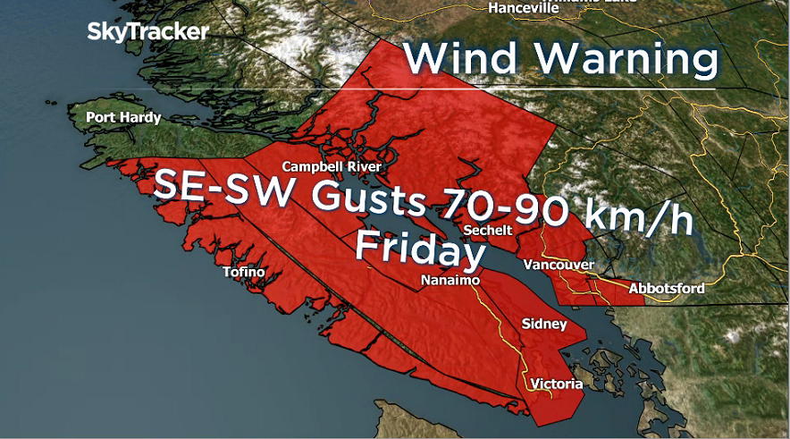
Global BC meteorologist Kristi Gordon says the exact timing of the storm is difficult to predict, but the worst winds are likely to come between 2 p.m. and 10 p.m., with gusts of up to 90 kilometres per hour possible.
WATCH: BC Evening Weather Forecast: Dec 13

And in the Fraser Valley, things could get even worse. In a wind warning issued Thursday night, Environment Canada said winds gusting up to 110 kilometres per hour are possible in the central and eastern valley including Chilliwack and Hope.
Gordon said that Thursday’s rainstorm left the ground saturated with water in many areas, meaning downed trees and power outages are possible.
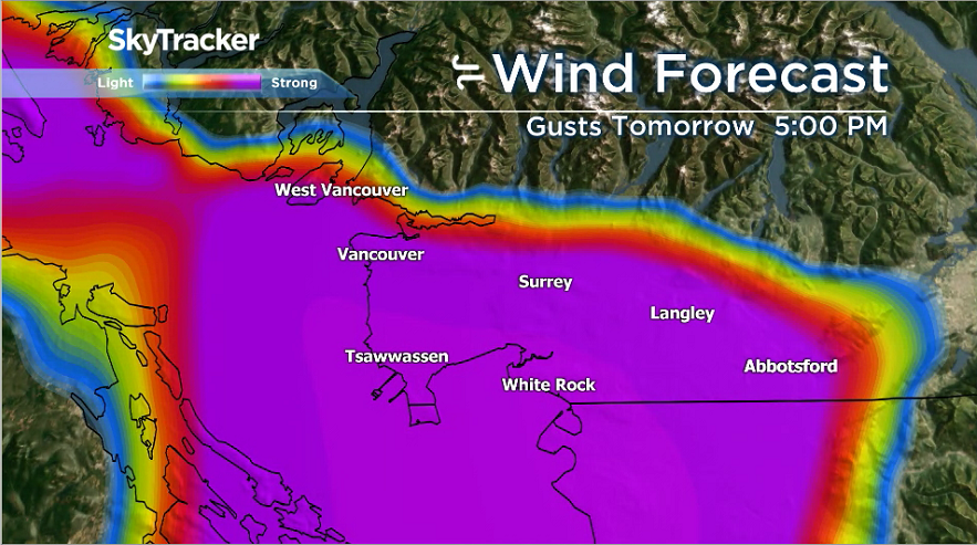
She added that winds from the south and southeast are expected earlier in the day, likely hitting areas south of the Fraser from Tsawwassen through Surrey and Langley.
In the afternoon, when the strongest winds are forecast to arrive, the winds are expected to become more southwest or westerly, Gordon said, meaning a larger part of Metro Vancouver could be affected.
BC Hydro spokesperson Kevin Aquino says the agency has all hands on deck.
“Crews are on standby. We’ll have our BC Hydro crews, call contractor crews and call centre agents so if the lights do go out, we’re ready to respond,” he said.
“We do prepare for storm season year-round so crews can activate emergency response plans at a moment’s notice. We do have a team of in-house meteorologists so we do know about (storms) before they hit.”
WATCH: Otters go for a swim on Still Creek Drive in Burnaby


On Thursday night, BC Ferries had already cancelled two sailings between Tsawwassen and Duke Point. With the storm bearing down, travellers are advised to check BC Ferries website before heading to the terminal.
The storm is slated to hit on Dec. 14, almost exactly 12 years after a windstorm that wiped out scores of trees in Stanley Park on Dec. 15, 2006.
That storm, Gordon explained, also struck after a series of rainy days.
Environment Canada meteorologist Trevor Smith said major tree damage around the region is a very real possibility, though said Stanley Park likely won’t see the worst of it.
“It’s a different direction, this one’s coming from the southwest. Perhaps different areas could be vulnerable, the tree roots could be soft,” he said.
“Downed trees and power I would expect that, I’d expect power outages in the Fraser Valley absolutely, but the Stanley Park event was a northwest windstorm down the Strait of Georgia.”
The Fraser Valley also remains under an Environment Canada rainfall warning, with up to 90 millimetres of precipitation possible by Friday morning.
Wind warnings remain in place for Howe Sound and across Vancouver Island as well.
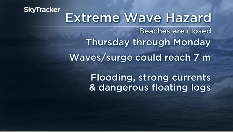
In Tofino, an extreme wave hazard advisory has been issued, with residents and visitors being warned to exercise caution on beaches and in oceanside areas.
“During this time period, combined seas are expected to reach up to seven metres on Friday and Sunday,” reads the warning.
“Very high wave conditions can create strong currents and shoreline flooding. Beaches can go from completely dry to several feet under water in only seconds during winter storms.”
Comments