

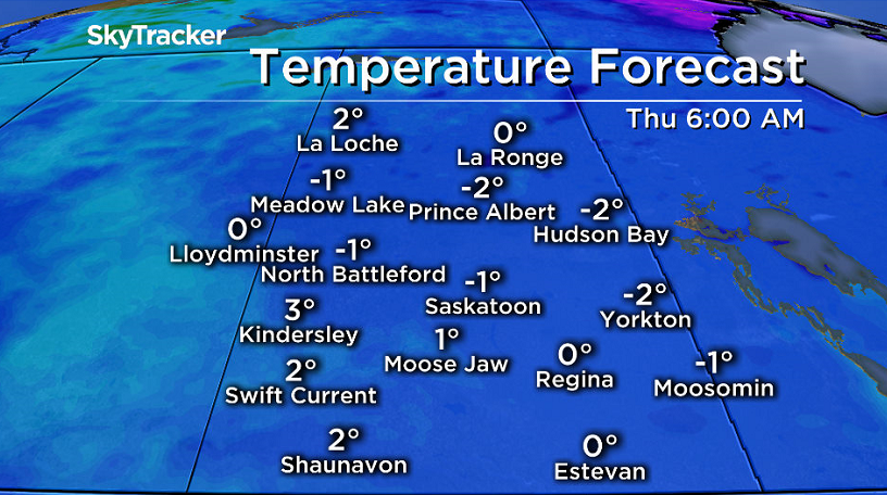
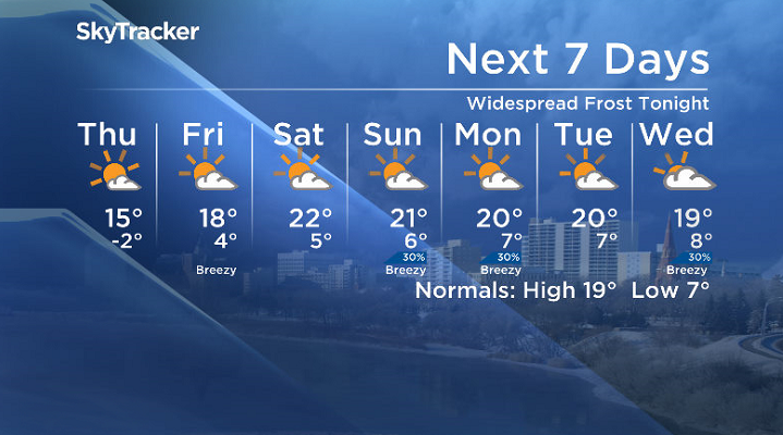
Widespread frost Thursday morning as temperatures fell below freezing.

Saskatoon Forecast
Wednesday
It was a cool and cloudy start to the day in Saskatoon as we sat around 2 degrees with light drizzle falling mid-morning.
The drizzle cleared out before noon as we warmed into mid-single digits, but mostly cloudy skies stuck around into the afternoon.
An arctic high pressure system dropped in from the north, carving skies out and clearing out the clouds to bring in some sunshine later in the afternoon with a daytime high struggling into double digits.
Wednesday Night
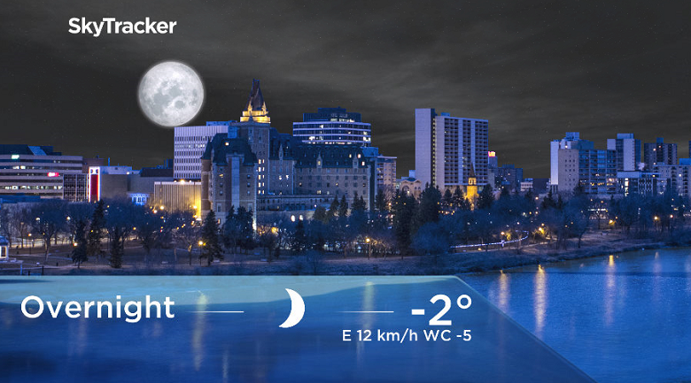
Mostly clear skies stuck around into the evening and that arctic high came and sat right over our area, helping drop us into our coldest night in over two weeks.
Temperatures fell below freezing by a few degrees with widespread frost across the region with a reminder to be sure to cover up or bring in any frost-sensitive plants.
It is too early in the season for frost advisories to be issued by Environment Canada, they don’t start being issued until the May long weekend and thus will start being issued when warranted on Saturday.
Thursday
-5 is what it’ll feel like Thursday with wind chill as you head out the door in the morning under sunny skies under that high pressure system.
Mostly sunny skies are expected to dominate the day with just a few clouds building in during the afternoon, which will help warm us up into the mid-teens for a daytime high.
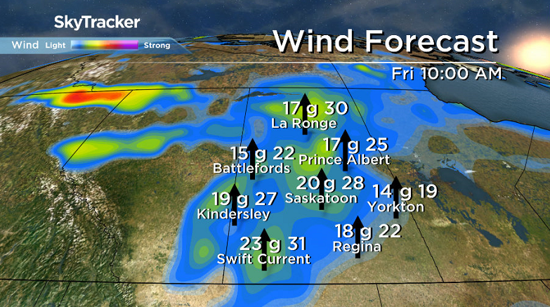
Friday
We’ll see a push of warmer air move in to end off the week with a moderate southerly breeze kicking in and a few more clouds building in during the day.
Temperatures will start off a few degrees above freezing, but will rise up into the high teens for an afternoon high.


May Long Weekend Outlook
Saturday looks like it’ll be the warmest day of the long weekend with temperatures climbing up to around 22 degrees before slightly cooler, but still 20 degree days slide in Sunday and Victoria Day Monday.
A mix of sun and cloud are expected to dominate the majority of the long weekend with a chance of rain and the risk of a thunderstorm late Saturday and into Sunday and a slight chance of showers on Monday.
This Your Saskatchewan photo was taken by Scot Muri near Hodgeville:

Saskatoon weather outlook is your source for Saskatoon’s most accurate forecast and is your one stop shop for all things weather for central and northern Saskatchewan with comprehensive, in depth analysis that you can only find here.
- Posters promoting ‘Steal From Loblaws Day’ are circulating. How did we get here?
- Video shows Ontario police sharing Trudeau’s location with protester, investigation launched
- Canadian food banks are on the brink: ‘This is not a sustainable situation’
- Solar eclipse eye damage: More than 160 cases reported in Ontario, Quebec
Comments