Advertisement

GALLERY: Fort McMurray wildfire before and after images capture devastation, recovery

One year ago this week, the devastating Fort McMurray wildfire swept through the northern Alberta community, destroying several neighbourhoods. In all, the fire consumed nearly 2,600 dwellings, or 10 per cent of the structures in the city.

READ MORE: ‘The Beast’ is still burning east of Fort McMurray 1 year later

One year later, some areas of the city are busy with construction. Here’s a before and after look at some of the hardest hit neighbourhoods and places where dramatic images were captured:

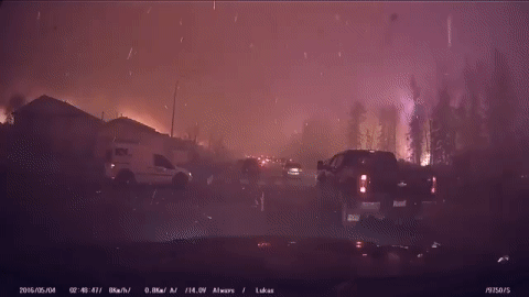
Bare land and homes under construction along a street in the Beacon Hill neighbourhood, where terrifying dash camera video showed fire and ash raining down on evacuating vehicles the afternoon of May 3, 2016.

Video taken during the May 3, 2016 evacuation showing fire and ash raining down on traffic moving slowly though the Beacon Hill neighbourhood, which was one of the hardest hit during the May 2016 wildfire in Fort McMurray, Alta.
One year later, blank lots and homes being rebuilt in the wildfire-ravaged Beacon Hill neighbourhood, where terrifying dash camera video showed fire and ash raining down on evacuating vehicles on May 3, 2016 in Fort McMurray, Alta.

New townhomes being built in the Beacon Hill neighbourhood.

Story continues below advertisement

The Fort McMurray Super 8 motel being rebuilt after burning down on May 3, 2016.

The Abasand neighbourhood, which was also destroyed by the wildfire.

Story continues below advertisement

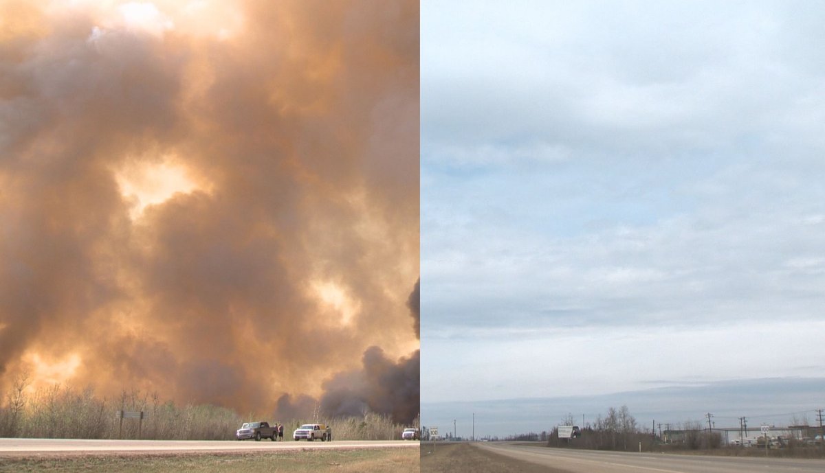
Highway 63, where traffic moved slowly as tens of thousands of people were evacuated from Fort McMurray.

Highway 63 south of Fort McMurray.

Burnt trees lining along the Responders Way bridge over Highway 63 in Fort McMurray.

Story continues below advertisement
Video taken during the May 3, 2016 evacuation showing traffic turning off the Responders Way bridge onto Highway 63 southbound as flames move closer to downtown Fort McMurray, Alta.
2017 video recreation of traffic turning off the Responders Way bridge onto Highway 63 southbound in Fort McMurray, Alta.


READ MORE: One year after wildfire, was the evacuation of Fort McMurray called at the right time?

BELOW: Collection of images from The Canadian Press showing more before and after images.

Story continues below advertisement

— With files from The Canadian Press


Sponsored content

AdChoices