

UPDATE: The blowing snow advisory mentioned in this story has ended

Blowing snow advisory, near zero visibility, 80 km/h wind gusts and more snow in the forecast.
Blowing Snow Advisory
A blowing snow advisory is in effect for Saskatoon, Prince Albert, Outlook and into the Moose Jaw and Assiniboia areas as well as into eastern Saskatchewan for poor visibility in widespread blowing snow today.
READ MORE: Winter storm closes highways, delays flights in southeastern Saskatchewan
Environment Canada says 70 to 80 km/h wind gusts this afternoon will bring blizzard or near blizzard conditions and people should consider postponing non-essential travel until conditions improve.

These winds combined with the fresh snowfall in the area will produce widespread blowing snow, with visibilities often 800 metres or less.
For the latest weather alerts download the Global News Skytracker weather app for iPhone, iPad or Android.
Motorists planning to head out on roads are advised to use caution and check in with Saskatchewan Highway Hotline before heading out.
Saskatoon Forecast
Today
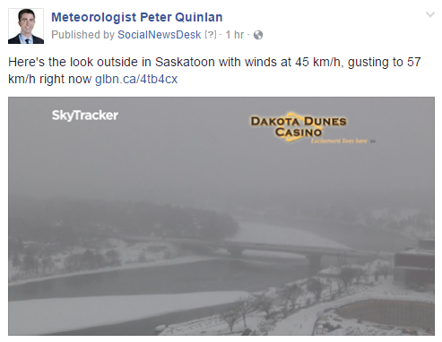
Visibility was down to 800 metres for the morning commute as winds gusted upwards of 80 km/h this morning with snow falling and loose snow blowing.
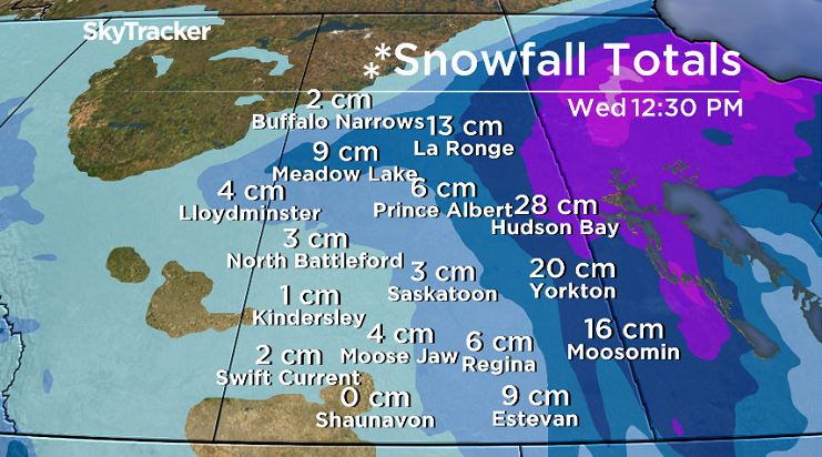
The deteriorated travel conditions were compounded by the fact that Saskatoon saw 16 to 20 centimetres of snow over the weekend and received an additional 5.6 centimetres as of 7 a.m. today.
The strong northwesterly winds at sustained speeds pushing 60 km/h with gusts upwards of 80 km/h are from a low pressure system tracking north through Manitoba.

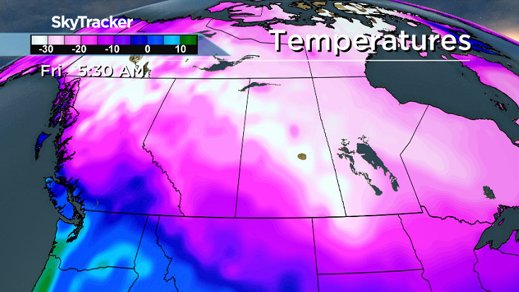
Cooler air has slid in behind the system with temperatures in the mid-minus teens all morning and wind chills in the -20s, a trend that’s expected to continue into the afternoon.
Winds will remain strong with light snow falling and loose snow blowing for the remainder of the day.
Tonight
The snow and winds will ease tonight as the low pressure system pushes northeast into Hudson Bay and skies are expected to clear out overnight, allowing temperatures to fall back into the -20s.
Wednesday
-33 is what it’ll feel like with wind chill Wednesday morning as you head out the door under mostly sunny skies to start the day.
Clouds are expected to roll back in midday as we warm up to an afternoon high a few degrees into the minus teens.
Thursday-Friday
An arctic ridge of high pressure will push into the north, bringing us into chilly air for the rest of the week under a mix of sun and cloud on Thursday and mostly cloudy skies with a chance of afternoon flurries on Friday.


Daytime highs will struggle to get into the minus teens both Thursday and Friday and lows will push from the -20s down toward the -30s with wind chills approaching extreme cold warning criteria of -40.
Weekend Outlook
A series of low pressure systems swinging by southeast of the province this weekend will keep us in the cloud with a good chance of some snow both days.
Daytime highs are expected to moderate back into mid-minus teens with lows just into the -20s.
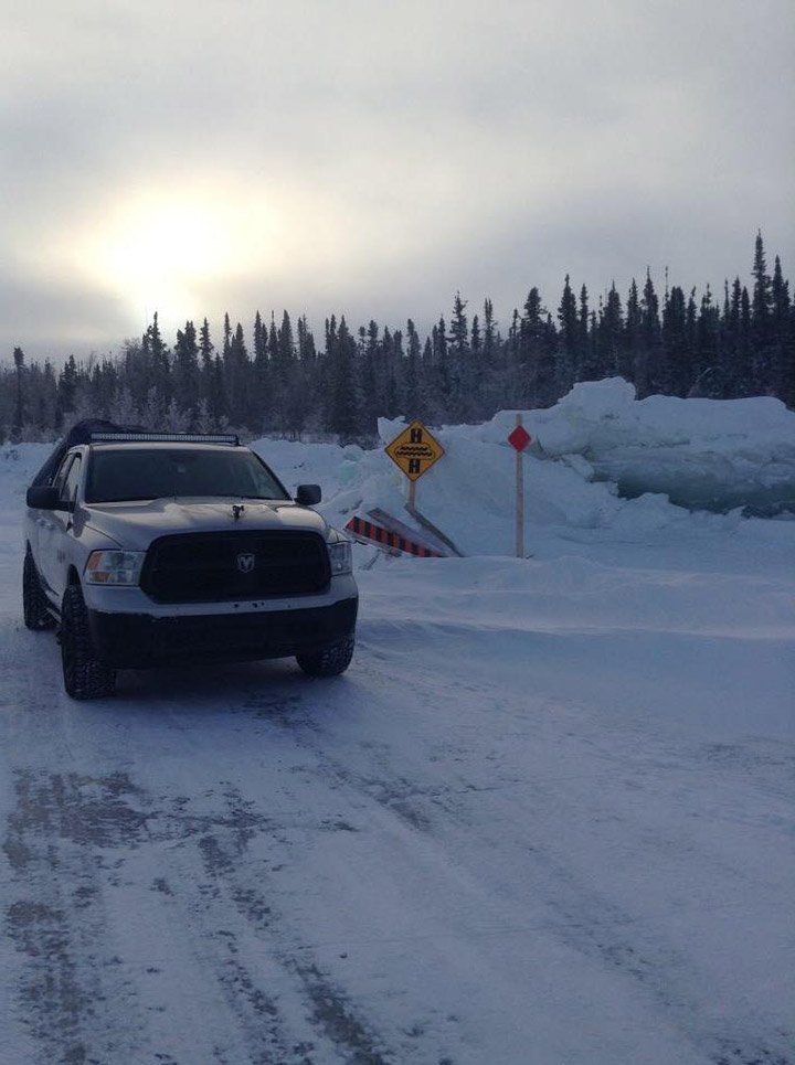
Mag Macdonald took this Your Saskatchewan photo near Fond-du-Lac.
Saskatoon weather outlook is your source for Saskatoon’s most accurate forecast and is your one stop shop for all things weather for central and northern Saskatchewan with comprehensive, in depth analysis that you can only find here.

Blizzard Warning
A blizzard warning is in place for Regina, Estevan, Yorkton, Kamsack, Humboldt and the surrounding areas.
Snow, combined with winds gusting to between 80 and 90 km/h, will reduce visibility to 400 near zero at times.
Blizzard conditions will continue throughout Tuesday before improving overnight and into Wednesday morning when the winds diminish.
Road closures are possible and outdoor activity is not recommended.
Snowfall Warning
Regions under a snowfall warning could get up to 20 centimetres of snow as the system moves through the province.
Strong northerly winds will generate blowing snow, which could make travel difficult at times.
Conditions are expected to improve Tuesday evening.
Comments