
Wednesday, February 08, 2017 – Weather forecast update at 4pm:

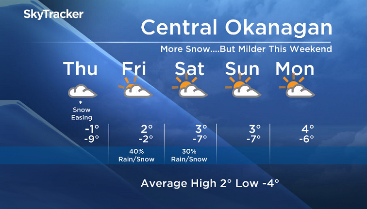
Snow will continue Wednesday night and Thursday morning under a southwesterly flow. The snow will taper off to flurries by Thursday midday or afternoon. Valley amounts will range from a few centimetres to 15cm. Areas in the North Okanagan, Shuswap, and Columbia regions will see the highest accumulations, along with areas near the mountains and high elevations.
Give yourself extra time Thursday morning as some of you may need to shovel before heading to work.
With warmer air pushing in aloft, there is a slight risk of freezing rain Thursday afternoon.


An upper ridge will build over the region this weekend, and we will gradually dry out and warm up.
Thursday’s daytime high range: -3 to +3
We will have the rest of your weather details coming up at 5 and 6:30 and 11pm – Hope you can join us!
~ Duane/Wesla
- Posters promoting ‘Steal From Loblaws Day’ are circulating. How did we get here?
- Canadian food banks are on the brink: ‘This is not a sustainable situation’
- Video shows Ontario police sharing Trudeau’s location with protester, investigation launched
- Solar eclipse eye damage: More than 160 cases reported in Ontario, Quebec
Comments