
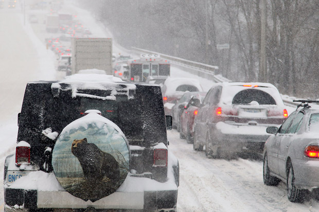
Communities west and north of Toronto will be dealing with their first large snowfall of the season as a cold front moves into the region late Thursday.

Environment Canada has issued a snow squall watch for areas including Newmarket, Georgina, York Region, Uxbridge, Beaverton and Durham Region.
The weather office said the lake-effect snow will bring around 15 centimetres of the white stuff in a 12 hour span.
Other areas affected by the weather advisory include parts of southwestern and central Ontario:
- Algonquin
- Bancroft – Bon Echo Park
- Barrie – Orillia – Midland
- Burk’s Falls – Bayfield Inlet
- Dufferin – Innisfil
- Elgin
- Grey – Bruce
- Huron – Perth
- London – Middlesex
- Oxford – Brant
- Parry Sound – Muskoka
- Peterborough – Kawartha Lakes
- Renfrew – Pembroke – Barry’s Bay
- Sarnia – Lambton
- Waterloo – Wellington


Environment Canada said the snowfall will continue into Friday.
Officials are warning motorists that visibility may be reduced at times in heavy snow and road closures are possible.
If you must travel, drivers are being reminded to keep others informed of your schedule and destination and to carry an emergency kit and mobile phone in your vehicle.
To get real-time weather for your area, download the Global News Skytracker weather app.
- Ontario NDP sets ultimatum for legislature keffiyeh ban, threatening to defy rules
- Muslim human rights activist in need of kidney finds help from Jewish community
- S&P/TSX composite rises, Nasdaq leads Wall St. rally after tech earnings
- Toronto officer charged with perjury, attempt to obstruct justice: police
Comments