

-30 wind chill values are in Saskatoon’s weather outlook as the big cool downs kicks in for December!

Saskatoon Forecast
Today
It’s a pretty mild and reasonable final day to November – characteristic of the above seasonal month that was, but that’s all about to change!
Light snow fell overnight leaving a dusting on the ground to brush off this morning, but nothing compared to what fell in southern Saskatchewan where up to 23 centimetres was reported over the past few days.
The snow and cloud cover kept us from dropping back too cool overnight with temperatures dipping back to -3 and wind chill values around -8 to start.
Mostly cloudy skies with a slight chance of flurries continue into the afternoon with temperatures pushing up to -2 by noon and expected to sit around there for the remainder of the day.
Tonight
Cloud cover will stick around tonight as temperatures dip back to around -5 overnight.
Thursday
-10 is around what it’ll feel like with wind chill when you wake up tomorrow morning before temperatures push up to around -2 for an afternoon high.
The first day of December will start off on a cloudy note with overcast conditions expected throughout the day and a slight chance of flurries in the evening.
Friday
The work week also looks to end on a mostly cloudy note now as the remnants of the trough that was supposed to swing through on Thursday gets delayed by a weak upper ridge over our area and keeps us in the clouds with a slight chance of flurries on Friday.
Temperatures will also remain fairly mild through the day with an afternoon high expected to be around -3, still well above our normal high of -6 for this time of the year.
Weekend Outlook
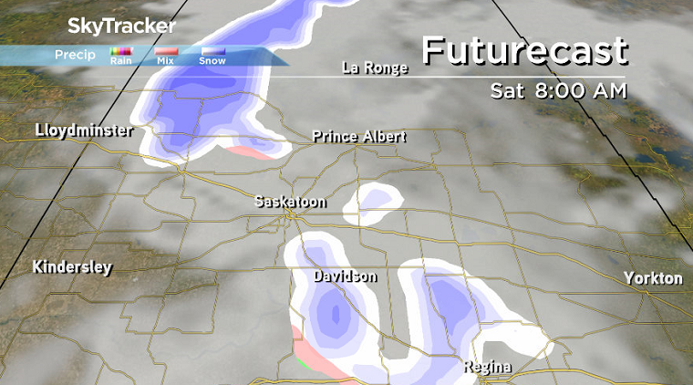
A developing low pressure system will swing through on Saturday and bring in a decent chance of snow under mostly cloudy skies before we finally get a return to a bit of sunshine on Sunday behind the system.


Much colder air will also inject behind that system, dropping our daytime high from -2 on Saturday to -4 on Sunday and then into minus double digits by next week.
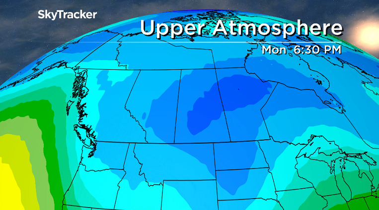
A massive upper trough takes hold early next week dropping temperatures into the mid-teens with morning lows down toward the -20s and morning wind chill values likely into the -30s.
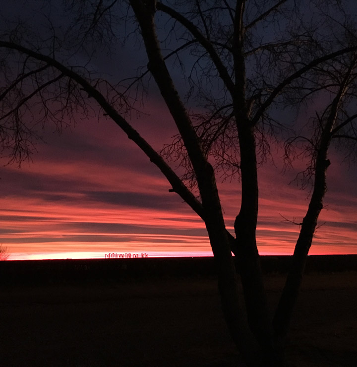
This Your Saskatchewan photo was taken by Dianne Ahrens in Rosetown:
Saskatoon weather outlook is your one stop shop for all things weather for Saskatoon, central and northern Saskatchewan with a comprehensive look at your local forecast that you can only find here.
- Canadian man dies during Texas Ironman event. His widow wants answers as to why
- ‘Shock and disbelief’ after Manitoba school trustee’s Indigenous comments
- Several baby products have been recalled by Health Canada. Here’s the list
- ‘Sciatica was gone’: hospital performs robot-assisted spinal surgery in Canadian first
Comments