

Two more days of 20 degree heat after Thursday before we shift into a new weather pattern for the new month.

Annual Rainfall
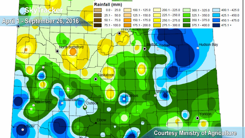
According to the latest crop report, Saskatoon has seen approximately 325 to 250 millimetres of rain since April 1, 2016.
The heaviest rainfall in the province fell northeast of the city in the Porcupine Plain area and southwest of Saskatoon in the Leader and Swift Current region where upwards of 500 millimetres fell.
According to the Ministry of Agriculture, 70% of the 2016 crop is now combined, which is below the five-year average of 79% combined for this time of the year.
Saskatoon Forecast
Today
The second last day of September started off with a few scattered showers and temperatures around seven degrees.
The mix of sun and cloud that sat over the area through the morning will continue into the afternoon with a slight chance of a scattered sprinkle through the afternoon.
The mercury shot up into the mid-teens by noon with an expected high potentially topping out at 20 degrees today!
Tonight
We’ll see some clouds stick around for the evening before they clear out overnight as temperatures dip back to around seven degrees.
Friday
Tomorrow will start off under a mix of sun and cloud once again before a mostly sunny end to the day.
The mercury will rise up into the 20s tomorrow as the upper ridge of high pressure builds back in the heat for the final day of the month.
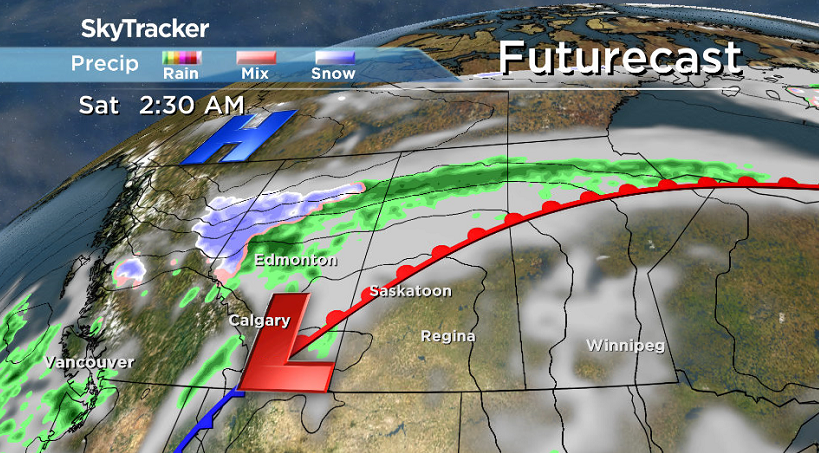
Weekend
Saturday definitely looks like your best bet for outdoor activities, with more sunshine than cloud cover likely and a daytime high around 23 degrees expected.
We’ll sit in the warm sector of a low pressure system swinging through on Saturday, but as it pushes northeast on Sunday, we’ll swing onto the cool side of the system as a cold front sweeps through.
As that occurs, winds will pick up and rain looks likely Saturday night into early Sunday morning before clouds clear again during the day.


As you’d expect behind a cold front, temperatures will also have taken a hit with an expected daytime high back into the mid-teens.
Work Week Outlook
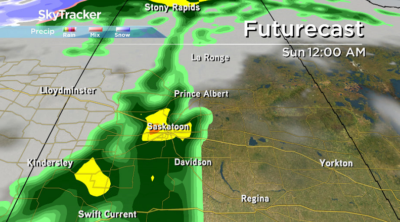
As we move into a new month, we’ll also move into a new weather pattern, at least for the first week of October!
Daytime highs will drop back from the mid-teens on Monday into low double digits for Tuesday and then possibly push back into high single digits mid-week as an upper trough swings through.

We’ll see more and more cloud cover heading into the middle of the week with a chance of rain on Wednesday as a system slides by southeast of the city and if we see precipitation on Thursday, it could even fall as snow.
We’ll continue to keep an eye on the situation as we currently are on the edge of the influence zone of that precipitation-carrying system and will bring you the latest as the date approaches.
This Your Saskatchewan photo was taken in Saskatoon by William Evitts:

Saskatoon weather outlook is your one stop shop for all things weather for Saskatoon, central and northern Saskatchewan with a comprehensive look at your local forecast that you can only find here.
- Posters promoting ‘Steal From Loblaws Day’ are circulating. How did we get here?
- Video shows Ontario police sharing Trudeau’s location with protester, investigation launched
- Canadian food banks are on the brink: ‘This is not a sustainable situation’
- Solar eclipse eye damage: More than 160 cases reported in Ontario, Quebec
Comments