
Wednesday, July 27, 2016 – Weather forecast update at 5pm:

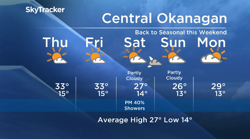
Warm temperatures will prevail, and the possibility of afternoon showers / thundershowers will disappear for the Okanagan for a couple of days.
The upper ridge that has helped bring us above seasonal temperatures for the last few days will stay with us until the weekend.
The email you need for the day's
top news stories from Canada and around the world.
Saturday, the ridge collapses and cooler air from the northwest will move in aloft over our region.
Daytime highs will drop back below 30C this weekend, and this trough of cooler air will reintroduce the possibility of showers Saturday evening.


Thursday’s daytime high range: 29C to 35C
We will have the rest of your weather details coming up at 5, 6:30 and 11pm – hope you can join us!
~ Duane English / Wesla Wong
More on Canada
- Posters promoting ‘Steal From Loblaws Day’ are circulating. How did we get here?
- Video shows Ontario police sharing Trudeau’s location with protester, investigation launched
- Canadian food banks are on the brink: ‘This is not a sustainable situation’
- Solar eclipse eye damage: More than 160 cases reported in Ontario, Quebec
Comments