
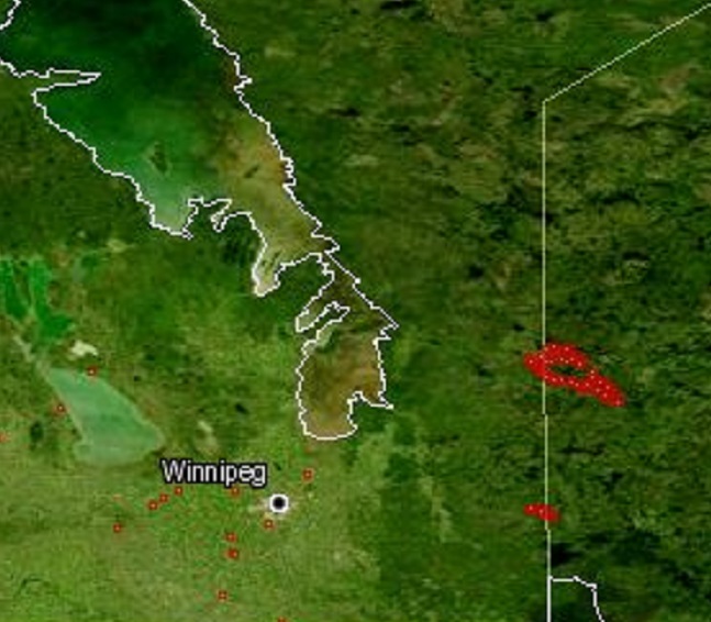
The wildfires along the Manitoba-Ontario border and the Whiteshell area continue to grow in size, forcing many people to flee their homes. The maps below show where the active fires and hot spots are located, according to Government of Manitoba data. For an interactive view of the wildfires, click on the links below.

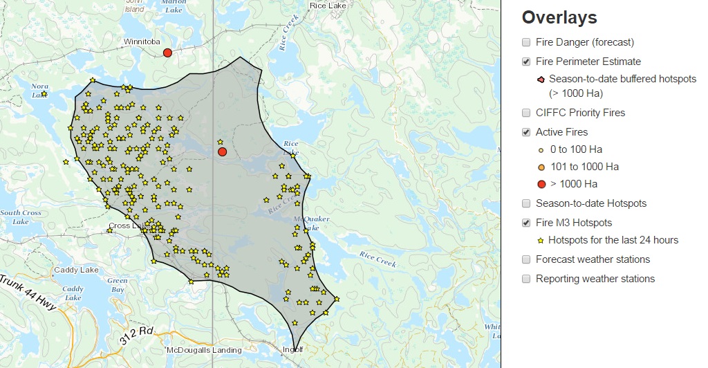
Whiteshell area
The map below shows the fire perimeter around the Whiteshell area as of Tuesday morning. It also shows hotspots and active fires according to size. For more information on the map click here.
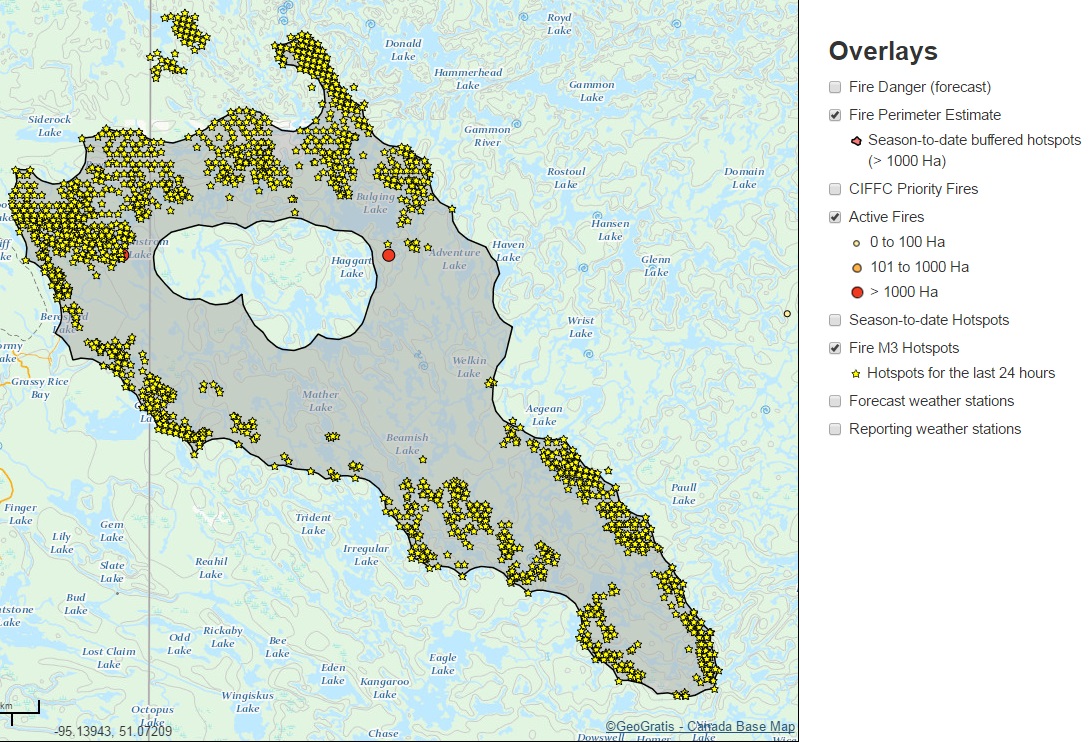
The fire has grown since it first sparked on May 5. The image below compares the size of the wildfire in the Whiteshell area from Friday, May 6 to Monday, May 9 using data from the province.
Manitoba-Ontario border
The map below shows the fire perimeter estimate around the Manitoba-Ontario border as of Tuesday morning. It also shows hotspots and active fires according to size. For more information on the map click here.


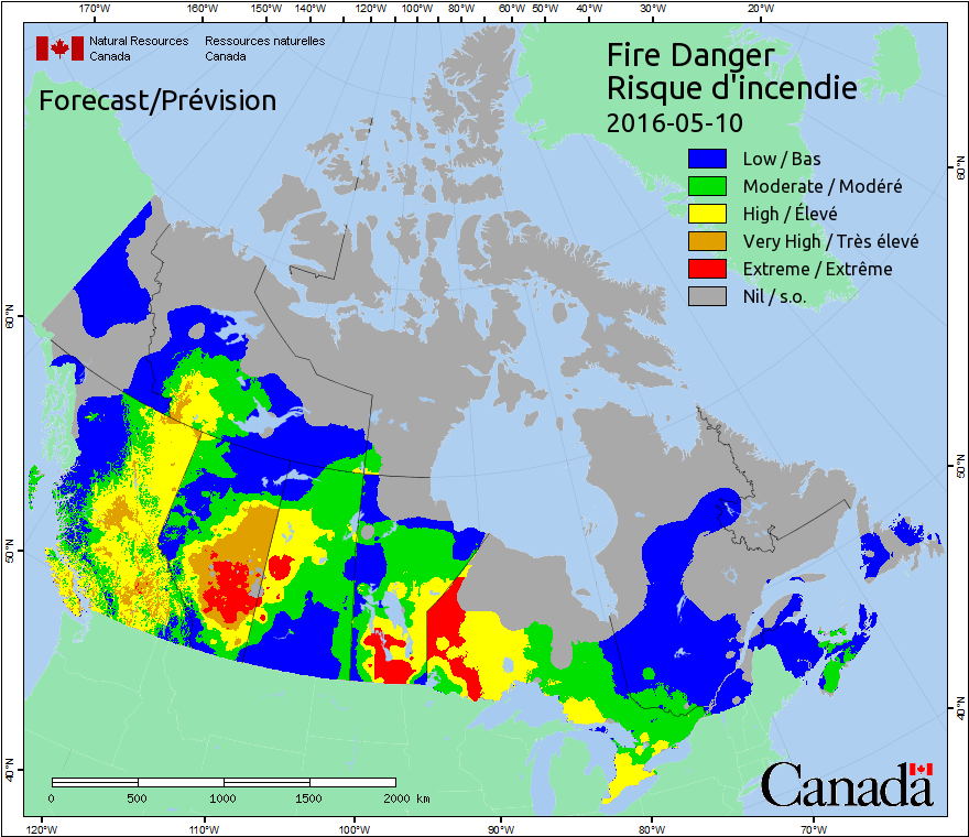
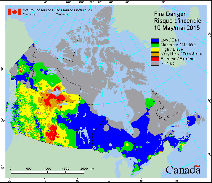
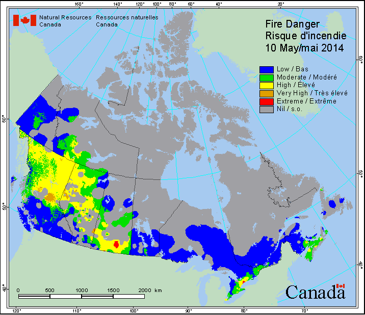
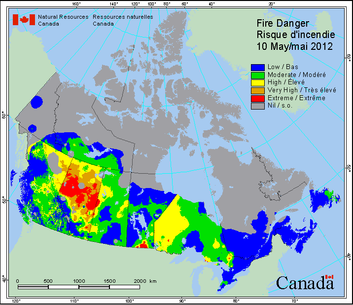
Wildfires across Canada
Wildfires are also burning across Canada, mainly in the prairies. The map below shows fire danger based on a scale from ‘low’ to ‘extreme’ over the past five years. For a full look at the interactive map, click here.


- As Canada’s tax deadline nears, what happens if you don’t file your return?
- Posters promoting ‘Steal From Loblaws Day’ are circulating. How did we get here?
- Drumheller hoping to break record for ‘largest gathering of people dressed as dinosaurs’
- Planning a summer trip to Quebec’s Îles-de-la-Madeleine? You’ll have to pay up
Comments