

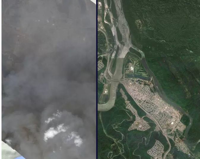
SOURCE: GOOGLE/TERRA BELLA

Before-and-after satellite images show fire-ravaged Fort McMurray engulfed in smoke Wednesday as over 80,000 residents fled and 1,600 homes were destroyed.
The space image was taken Wednesday by Terra Bella, a subsidiary of Google that operates satellites. A larger original version can be seen here.
Use the slider above to orient yourself to features on the ground.
The satellite image clearly shows smoke pouring from the devastated Abasand and Beacon Hill neighbourhood. In Beacon Hill, 80 per cent of the homes are reported as destroyed.
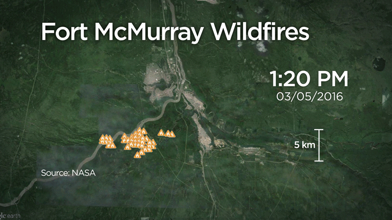
In the updated image below, which shows fire data up to Wednesday morning, we see fire invading the Timberlea and Parsons Creek neighbourhoods in the city’s north, which were unscathed yesterday.
READ MORE: Where Fort McMurray fire evacuees can get help and information
WATCH BELOW: Global National reporter Eric Sorensen explains in an animation how temperature inversion helped fuel the fire that lead to Tuesday’s sudden explosion of flames in Fort McMurray.

Comments