
Weather update: Tuesday March 31th 4:30pm

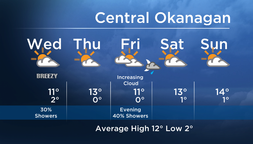
An upper trough will swing across Western Canada Wednesday. Nothing significant is expected, but the cooler air aloft will make it unstable and although we will see breaks of sun, isolated showers are possible.
On Thursday the next upper ridge will move in. This will bring us an even brighter day ahead with no precip expected.
However by late Friday this ridge will shift to the east and a return to a southwesterly flow aloft on the weekend will bring in the chance of evening showers on Friday.


At this time, models are alluding to just a small precipitation chance for Saturday and Sunday when an upper trough digs to the south of us.
Wednesday’s daytime high range: 7 to 14C
More details coming up at 5, 6:30 and 11pm!
~ Duane English / Wesla Wong
- Posters promoting ‘Steal From Loblaws Day’ are circulating. How did we get here?
- Video shows Ontario police sharing Trudeau’s location with protester, investigation launched
- Canadian food banks are on the brink: ‘This is not a sustainable situation’
- Solar eclipse eye damage: More than 160 cases reported in Ontario, Quebec
Comments