
Video: Winter wonderland for some, horrible mess for others. Shirlee Engel & Eric Sorensen report on today’s severe weather

TORONTO – The edge of the intense storm that moved up the eastern United States struck Ontario and Quebec late Tuesday night.
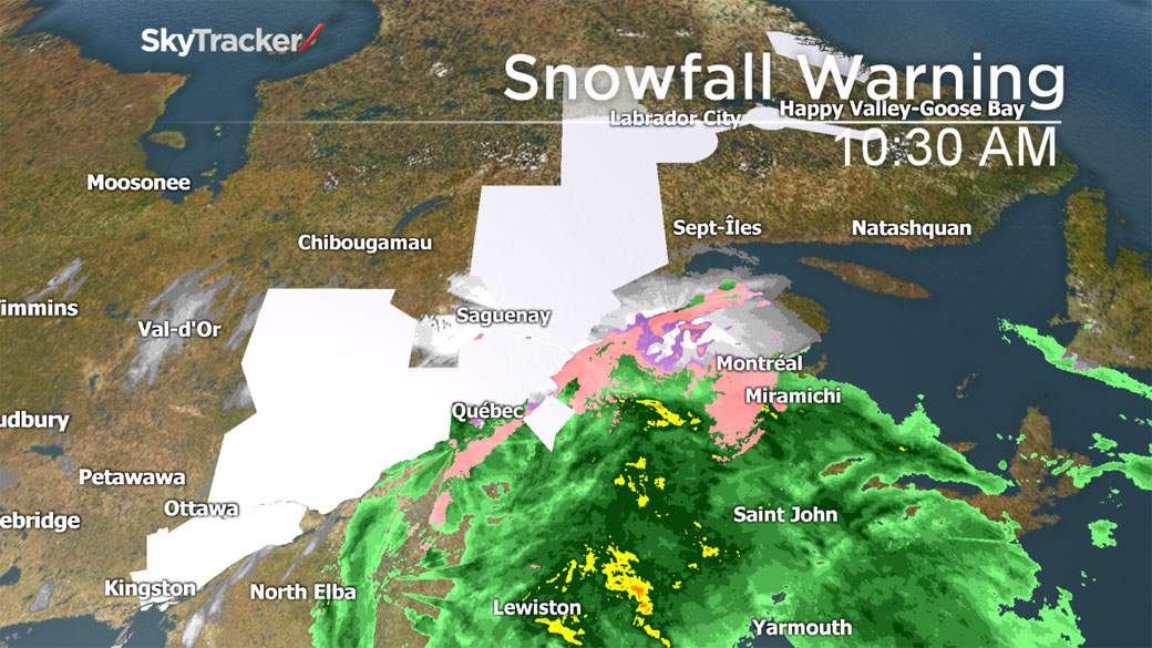
As of 6 a.m. ET, Environment Canada was reporting at least 23 cm of snow at the Ottawa airport.
READ MORE: Winter tires: Do you really need to buy the most expensive brand?
Several flights in and out of Ottawa have been cancelled or delayed as the storm continues to affect the eastern part of the country as well as the U.S.
Other parts of Ontario were luckier, however.

Get daily National news
In Toronto, the city only recorded 7 cm of snow. But as the storm headed further east, areas saw heavier bands of snow. Peterborough received 8 cm, Kingston 15. More moisture and colder temperatures resulted in more snow for areas in northeastern Ontario.
As the system moved into Quebec, it dumped 10 to 20 cm of snow in the southwestern part of the province. In the Laurentians, that amount was higher — closer to 25 cm.


Though Montreal is over the worst part of it, the snow continues to fall in the northwestern part of the province. A further 15 to 25 cm are expected in some areas.
But the snow isn’t the only thing that Quebec residents can expect: in some areas like Charlevoix and Kamouraska, there is the chance of freezing rain before the temperatures rise and change the precipitation to rain.
And in the extreme northern part of the province between 50 and 90 mm of rain is expected.
Video: Ottawa hit with the first major snowfall
Comments
Want to discuss? Please read our Commenting Policy first.