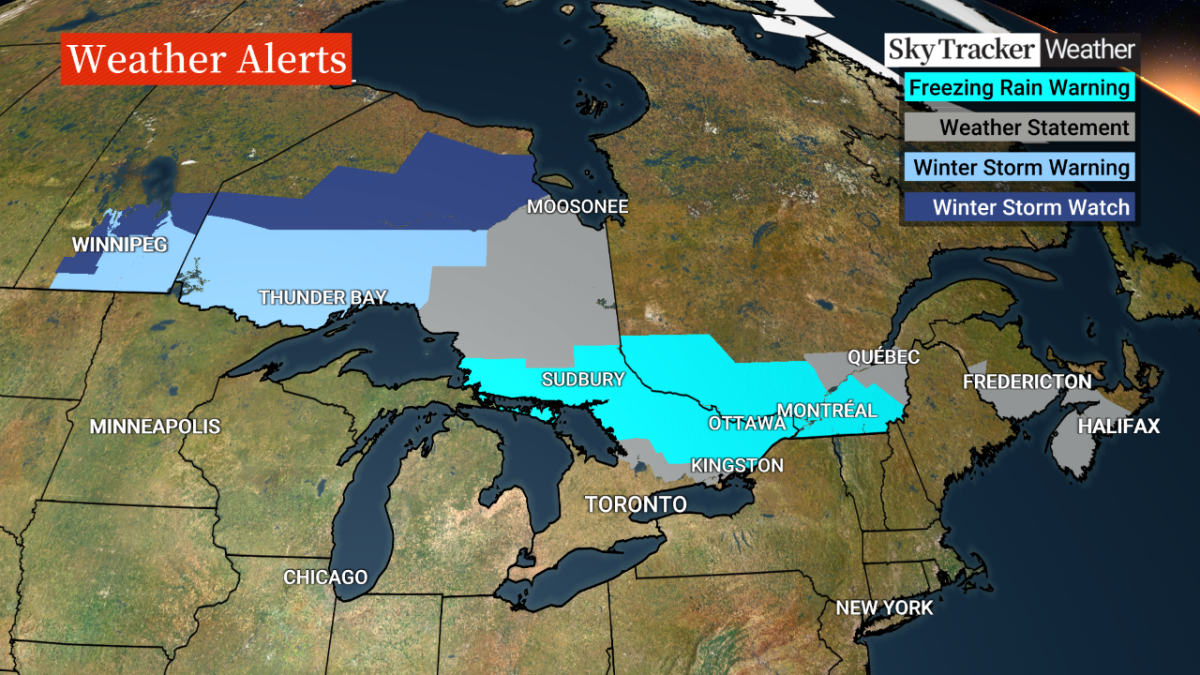
Canada is expected to receive some dicey weather this week, but it may be the last push of wintery weather before spring truly arrives across the country, according to Global News chief meteorologist Anthony Farnell.

Farnell said Tuesday that a big storm is forming in the U.S. and eastern half of Canada, which could bring 15 to 30 cm of snow and near-blizzard conditions in northwest Ontario and Manitoba.
There is also a freezing rain warning from Sault Ste. Marie, through Sudbury, North Bay, the Ottawa Valley and Montreal. Farnell said there could be an ice storm in those areas, with 15 to 20 mm of ice accretion that could lead to power outages.
In addition, more tornadoes are expected in the U.S. in Illinois, Iowa and down to Kansas and Arkansas. The storms may threaten southern Ontario on Wednesday.

Get daily National news
“It could be the first severe weather day of the year,” Farnell said.
Tornadoes have wreaked havoc in the U.S. recently, leaving a trail of destruction and dozens dead.
- Snow in the forecast for Calgary, Edmonton areas ahead of the long weekend
- ‘Stay connected’: Atlantic Canada’s messy winter has been hard on students, seniors
- Old Man Winter wallops B.C.’s Mainland/Southwest region, major highway closed
- Calgary hit by unexpected blast of spring snow, causing dozens of crashes

While Farnell said there may not be as many tornadoes in the U.S. as late last week, with as many as 70 counted, they could still pose a threat and may hit during the night, which means people may not have enough time to evacuate.
The rocky weather could be the last hurrah of winter, though, as Farnell said that by Easter weekend, things will heat up for much of Canada, with temperatures expected to be above normal into mid-April.
“It’s going to feel like spring,” he said. “You’ll look back on your calendar and say, ‘Easter weekend, that’s when spring really arrived across the country.'”


Comments
Want to discuss? Please read our Commenting Policy first.