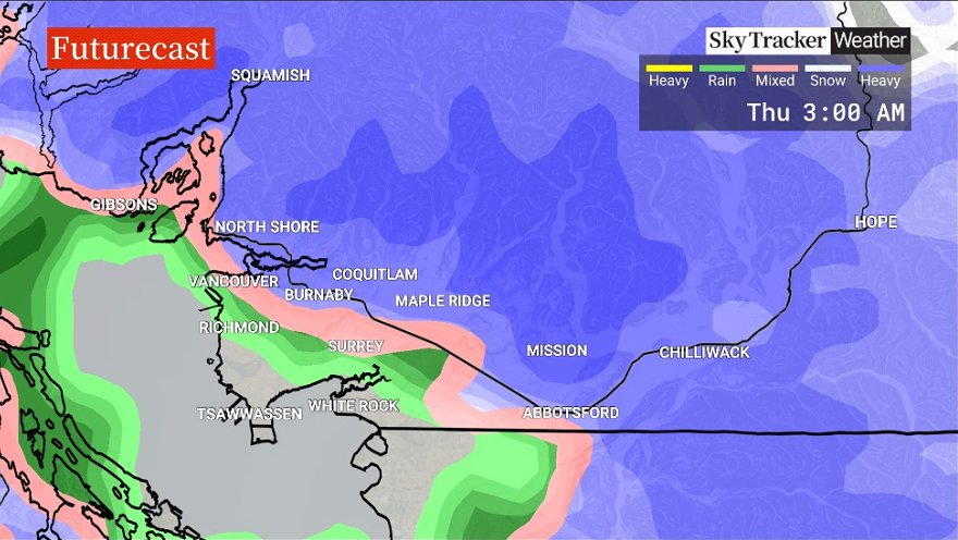
More snowfall for B.C.’s South Coast is expected to hit the region, spurring warnings and statements from Environment Canada.

Snowfall warnings have been issued for Whistler, Squamish, Fraser Valley, Coquihalla Highway, Nicola, Howe Sound, North Coast, Central Coast and Fraser Canyon regions.

A special weather statement has been issued for Metro Vancouver for snowfall.
“Showers or wet flurries will develop Wednesday afternoon or early evening as daytime highs reach 3 C,” said Global BC Meteorologist Kristi Gordon.

Get daily National news
“The precipitation will become heavier and more consistent late evening and overnight. As temperatures drop to 2 C for much of lower elevation Metro Vancouver, most areas will experience rain or a rain-snow mix leading to no accumulations.
“Meanwhile, regions above 200 meters could cool off to 0 to -1 C overnight bringing the potential for snowfall accumulations by Thursday morning. The amount of snow will vary significantly depending on the temperature overnight.”
For the snowfall warnings, most regions are forecast to receive 15 to 30 cm of snow.
“A Pacific frontal system is moving in from the north,” Environment Canada said. “Surfaces such as highways, roads, walkways and parking lots may become difficult to navigate due to accumulating snow.”
Drivers are being warned to adjust their driving to suit changing road conditions.
— With files from The Canadian Press


Comments