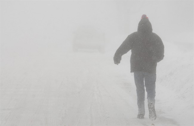
Snow squalls are expected to accompany the rest of a frigid Friday in the London, Ont., area, according to Environment Canada.

The national weather agency first issued a snow squall warning Thursday, with squalls arriving early that evening. As the snow continued to fall through the morning, the warning was updated shortly after 9 a.m. Friday and is now set to last through to the evening.
The snow squalls are coming off Lake Huron and London is set to see local snowfall accumulations of 10 to 20 centimetres.
Environment Canada’s warning also covers Komoka, Parkhill and Strathroy, as well as eastern and western Middlesex County.
The heavy snow will be combined with northwesterly winds gusting 50 to 60 km/h, creating the chance of near-zero visibility.
Environment Canada says this weather can lead to rapid changes in conditions, adding that “changes from clear skies to heavy snow within just a few kilometres are common.”
Conditions are expected to improve this evening as snowfall intensity and winds gradually diminish.
The snow squalls come as London grapples with a cold snap stemming from an Arctic air mass making its way across the province, prompting the Middlesex-London Health Unit (MLHU) to issue its first cold weather alert of the year.
- What is a halal mortgage? How interest-free home financing works in Canada
- Capital gains changes are ‘really fair,’ Freeland says, as doctors cry foul
- Ontario doctors offer solutions to help address shortage of family physicians
- Canada will take bigger economic hit than U.S. if Trump wins election: report
The alert was initially expected to expire at some point Friday, but shortly after 2:30 p.m., the MLHU announced the alert would extend into Saturday morning.
As of that time, Environment Canada’s forecast calls for temperatures to dip to -17 C Friday night with wind chill values near -24. Similar conditions are expected on Saturday morning.
Health officials say the cold weather alert will be lifted once wind chill values rise above -20, the health unit’s cold weather alert threshold.
In the meantime, folks are asked to layer up and dress for the weather if they need to be outside. City warming centres will be open on Friday and more information about extreme cold, hypothermia and frostbite can be found on the health unit’s website.
Londoners longing for warmer days may be happy to learn the cold snap won’t last for long.
Speaking with Global News on Thursday, Steven Flisfeder, a warning preparedness meteorologist with Environment Canada, says above-seasonal temperatures are forecast to arrive mid-next week.
The same can be said for the rest of February.
“How warm that’s going to get? That’s going to be a day-to-day, week-to-week analysis, but for the time being, we’re expecting above-seasonal temperatures to continue through most of February,” Flisfeder added.
“Most of our longer-range guidance is in agreement that it’s really not until the very end of February, leading into March, that we start to get back towards near-normal (temperatures) and possibly a bit below normal into early March.”
— with files from Global’s Matthew Trevithick.


Comments