

It’s a warmer week ahead, though winter isn’t fading away.

Light snow is expected to move in during the day on Monday as temperatures make their way just above freezing.
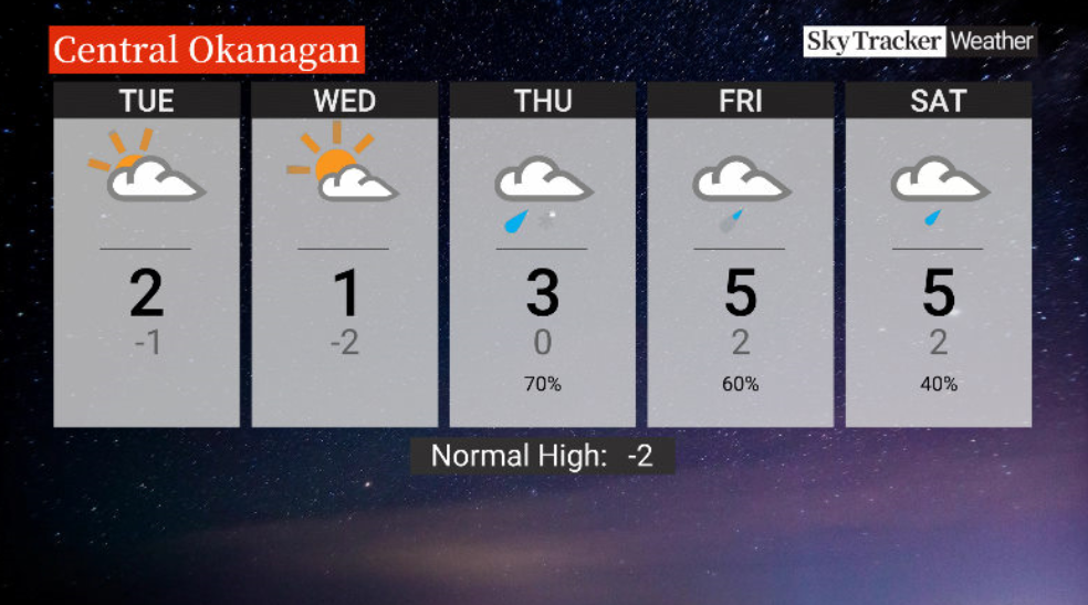
The risk of flurries eases Monday night as the mercury dips below freezing.
Mostly cloudy skies stick around into Tuesday morning with the chance of some late-day sunny breaks as afternoon highs get back just above freezing.

Get breaking National news
After some morning valley cloud, sunny breaks are even more likely Wednesday afternoon with a high around 1 C.
A push of milder air rolls in to finish the week with the risk of rain and snow Thursday and a high around 3 C before precipitation shifts to showers on Friday with a high near 5 C.
The weekend ahead will see similar highs with the chance of a few showers.


For weather on the go download the Global News SkyTracker Weather App for iPhone, iPad or Android.


Comments