


Hydro One says it’s preparing to respond to a “potentially damaging” storm that’s expected to hit Ontario just before Christmas.

The electricity company said in a statement Wednesday that it is urging customers to “prepare for an extended power outage” by ensuring emergency kits are stocked up.
“We’re closely monitoring the weather and using our outage prediction tool to get our crews in position and ready to get the lights back on for our customers as many prepare to celebrate the holidays with family and friends,” the chief operating officer of Hydro One David Lebeter said.
“We want our customers to know that we have crews, damage assessors and support staff ready to respond as quickly and safely as possible should outages occur.”
The company said their efforts come just after they restored power to more than 218,000 customers following last week’s storm.
Hydro One customers can report outages by texting 92887 (WATTS), through the company’s outage map and app or by calling 1-800-434-1235, the statement said.

Get breaking National news
If an outage happens, restoration times will be determined after damage is assessed.
The winter storm is expected across parts of southern Ontario just ahead of Christmas Day — and will impact travel plans for most Ontarians planning to commute back and forth for the holidays.
According to Global News’ Chief Meteorologist Anthony Farnell, the storm will arrive from the U.S. Midwest and will rapidly deepen over the Great Lakes on Friday and early Saturday — Christmas Eve.
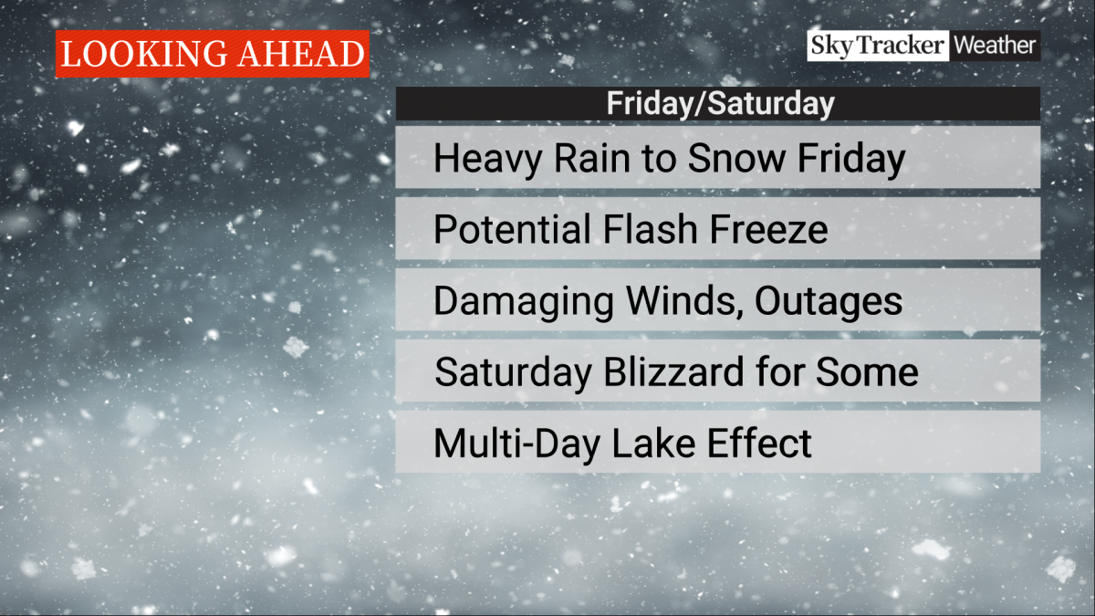
Although Friday will see mild temperatures as the system moves in as rain, Farnell said it will be replaced with Arctic air and snow as Friday progresses, possibly resulting in a flash freeze.
- How the Northern Tornadoes Project helps verify twisters as Alberta on track for record year
- Inquiry hears avalanche danger moderate on day of 2021 fatal Banff snow slide
- Air quality warning in Edmonton, much of Alberta due to N.W.T. wildfire smoke
- How do wildfires create lightning, pyro tornadoes and thunderstorms?


For the Greater Toronto Area, Farnell said the timing of the cold front appears to be mid-morning on Friday.
He also said blizzard conditions could develop late Friday into Saturday for areas west of the GTA and possibly parts of cottage country.
“Winds are likely to be the biggest concern later Friday into Saturday and could gust from 100 km/h to 120 km/h near the shore of Lake Huron and Lake Ontario,” Farnell continued.
“This will combine with a period of heavy snow and in some spots persistent lake effect snow that lingers into Christmas Day.”
On Saturday, near-zero visibility, frigid temperatures and drifting snow will make travel extremely difficult, especially around exposed highways outside of the major cities.

Comments
Want to discuss? Please read our Commenting Policy first.