
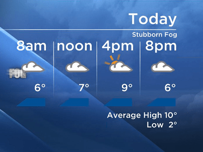
Mother Nature is making sure we are getting our fog fix.

The winds continue to be light, keeping this stubborn fog in the forecast.
Plus an inversion is still in place; the weather balloon reported 6 degrees at the airport this morning and 10 degrees at 1800 metres.
We continue to sound like a broken record but this upper ridge/blocking pattern mean very little changes in the forecast.
With the inversion holding strong, most areas in the Shuswap, Arrow Lakes, North Okanagan and the Central Okanagan are not seeing much afternoon clearing (if any) keeping daily highs between 8 and 10 degrees.

Get daily National news
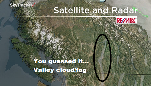
However the Southern Okanagan and the Boundary regions are drier and the morning fog/cloud has been dissipating in time to allow temperatures to be above seasonal with highs between 13-17 degrees.
 With all this said – models are continuing to suggest a gradual pattern shift starting Thursday when the ridge flattens.


By the weekend an upper trough will move through our region bringing in cool air to replace the warm air aloft.
Showers are likely to move through the Southern Interior on Sunday.
See you tonight at 5, 6:30 and 11pm.
~Duane and Wesla
Comments
Want to discuss? Please read our Commenting Policy first.