
Researchers with Western University’s Northern Tornadoes Project (NTP) confirmed Tuesday that a weak tornado touched down in the area of Wyoming, Ont., last week causing some property damage but luckily no injuries.

The EF0-rated tornado, the lowest severity on the EF scale, touched down around 6:35 p.m. on July 19 near the intersection of Confederation Line and Minelly Road, researchers said.
The twister, with maximum estimated wind speeds of 125 km/h and a maximum path width of 200 metres, travelled east for roughly 2.1 kilometres before dissipating near Confederation Line and South Plympton Road.
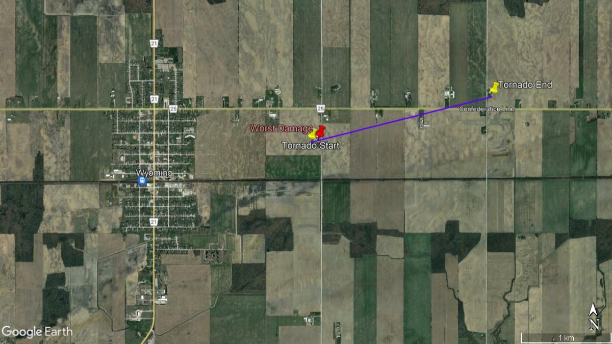
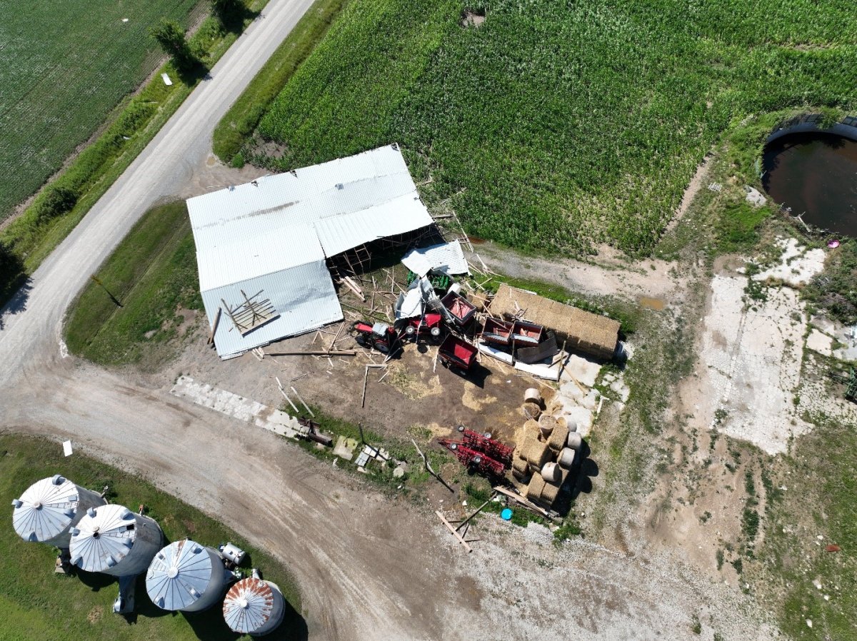
Some trees were damaged and uprooted in the Wyoming area, researchers said, however the worst damage was found near the start of the tornado’s path, where an open-construction barn collapsed.
“(The tornado) was probably only on the ground for five minutes or so… The storms weren’t moving that fast, so probably just took its time to get from that farm across the road and damage the trees that it did,” said Dave Sills, NTP’s executive director.
The investigation will continue with the use of high-resolution satellite images to look for any additional damage and to determine whether any other tornadoes may have touched down.
The Wyoming twister came as part of a brief supercell thunderstorm, or rotating thunderstorm, which passed through the area last Tuesday evening, a day before a separate line of thunderstorms would prompt tornado watches and warnings in the region.
“The storm itself was a little bit trickier to identify as a supercell. (The) reason being, we were actually watching for these thunderstorms developing significant amounts of rain, what we call ‘training thunderstorms,'” said Monica Vaswani, a meteorologist with Environment Canada.
“Training thunderstorms” describes the scenario where a storm cell moves, however a new cell forms over the path of the previous one, resulting in significant rainfall over a small area, according to the U.S. National Weather Service. On radar, it can give the appearance that a storm cluster is staying put or going backward.

“The reports that we were receiving, mostly through social media at the time, a lot of them were focusing on flooding that was occurring in the area … identifying it as a supercell itself was a little bit challenging in this case,” she said.
“These storms were developing off of what we call a lake breeze boundary. That boundary essentially would have acted as a cold front, would have helped push these cells upward and also helped in the rotation.”
No weather advisories were issued by Environment Canada for the Wyoming tornado.
The next day, a line of severe thunderstorms crossing southern Ontario prompted tornado watches and warnings for the London area, however no tornado touched down. An EF1 downburst was reported which caused some damage, according to Sills.


“(It) just points to how difficult forecasting and warning for tornadoes is. On July 20, the conditions seemed to be really well-suited for tornado development … But there just was a missing ingredient, apparently, for the development of tornadoes,” he said.
According to Vaswani, predicting tornadoes in southwestern Ontario isn’t as clear cut as it may be in other areas, such as the central United States, dubbed “Tornado Alley.”
“In the U.S. plains where we see these big tornadoes, they’re sometimes a little bit easier to predict down there. Here, because of the Great Lakes, we actually have a whole different set of conditions that can influence the weather,” she said.
“This is a great example of that,” she said of the Wyoming twister, “because these lake-breeze boundaries, they’re not usually what we think of when we’re thinking of a supercell thunderstorm.”
The cold front which moved into the region the following day is when forecasters would be anticipating more widespread severe weather. “We’re kind of looking out for that a little bit more,” she said.
“But when we have these lake-breeze boundaries, they can create what we call these little spin ups, essentially, that can sometimes go undetected, especially because they’re on such a small scale.”
The purpose of the NTP, launched in 2016 and expanded in fall 2019, is to report and catalogue every tornado that touches down in Canada.
The project utilizes planes, drones and high-resolution aerial and satellite imagery to find tornadoes in more remote areas that would otherwise go unreported.


Comments