

Almost exactly on cue, heat and humidity arrived in Ontario with the summer solstice.

These short bouts of very hot weather followed by thunderstorms and a cool-down will be a common occurrence this season.
The centre of the ridge, often called a heat dome, will establish itself over the central plains in the United States but at times the temperature will also soar around the Great Lakes.
This should be enough to deliver a warmer than normal summer to the Highway 401 corridor in southern Ontario, but with the really hot and sticky weather holding off until late July and August.
Temperatures elsewhere in the province will be near seasonal to slightly above normal.
That central plains ridge puts most of Ontario under northwest flow where small disturbances and fronts cause frequent thunderstorms, but also bring temporary relief from the heat and mugginess.
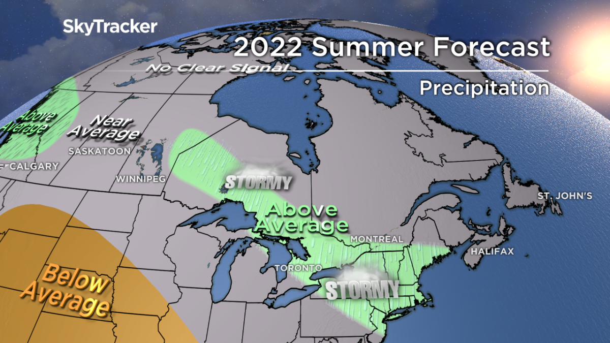
These thunderstorm complexes are sometimes called “ridge runners” because they run around the periphery of the high pressure ridge.


Get breaking National news
They can also produce very heavy rainfall and damaging winds which is something we’ll likely see more of this summer than in the past.
The derecho over Victoria Day weekend was just an example of what these thunderstorm complexes can do.
With a lack of prolonged heat waves and no major droughts predicted, fewer forest fires are expected this year across northern Ontario.
So to recap, a seasonal to slightly warmer than normal summer but with more rain and storminess than average across a large swath of the province.

Comments
Want to discuss? Please read our Commenting Policy first.