
Officials with the City of Calgary are monitoring weather patterns and melting snow in higher elevations to determine the city’s risk for flooding this year.

The around-the-clock monitoring operation has been in place since the beginning of May, and focuses on weather patterns and impacts on spring runoff from the mountains.
The city’s emergency management committee heard on Tuesday that the alpine snowpack is 20 to 40 per cent higher than average this year.
“We haven’t seen much of that melt occur yet, so natural streamflow remains almost at winter levels. It’s below the normal flows right now,” City of Calgary watershed analysis leader Frank Frigo said.
According to Frigo, flow on the Bow River is currently sitting between 80 and 90 cubic metres per second, while normal flows for this time of year are around 150 cubic metres per second.
Frigo said the conditions are favourable for the city’s reservoirs and water management, and gives services more time to respond to any change to levels.
“What it does do is give our reservoir operators, both at the Glenmore and the TransAlta structures, more flexibility to understand that melt is going to occur later in the season,” Frigo said.

Get breaking National news
“Therefore, the usual tension between lowering levels to have adequate room for flood attenuation versus having fuller reservoirs to ensure we have more late season water is a little more balanced.”
That has city officials looking to the long-term forecast to determine the risk of flooding in Calgary this year.

City of Calgary river engineering team lead Sandy Davis told committee that the forecast is looking dry and cool for the early summer months.
“It’s still too early. We don’t see those big rains that cause river flooding in Calgary more than three to five days out,” Davis told committee. “That’s where my team is monitoring conditions to watch for those big rain systems and provide early warning up to a week beforehand.”

Committee heard several flood-risk-related presentations from officials with the Calgary Emergency Management Agency (CEMA), TransAlta, as well as the Alberta Emergency Management Agency.
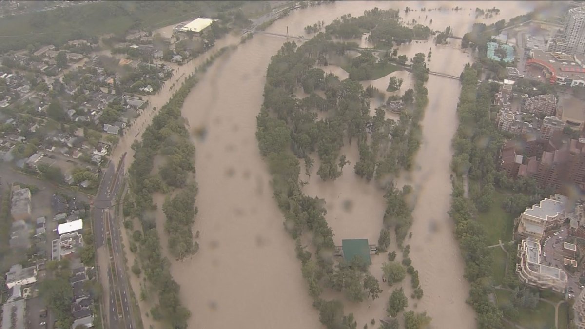
According to CEMA chief Sue Henry, four of the city’s 15 assessed disaster risks involve flooding on the Bow and Elbow rivers.
“We know flood risk is increasing because of climate change, whereas dam risk is a stable risk thanks to the incredible controls and dam safety programs that are in place,” Henry told committee.
“When we talk about a one-in-100-year flood, that doesn’t mean that since we had that flood in 2013, we shouldn’t expect to see that level for 100 years. It means we have a one per cent chance of reaching that flood level on any given year.”
Since the devastating floods in 2013, several projects have mitigated the city’s flood damage risk by 55 per cent. That damage risk is expected to be mitigated by a total of 70 per cent once the Springbank Off-Stream Reservoir is complete in 2025.
Henry said CEMA and partner agencies underwent a flood-related training exercise last week as a refresher on how to respond to such an event in Calgary.
“We learned a lot from 2013 and we continue to update our best practices and continue to lead the country in flood management,” Ward 11 Coun. Kourtney Penner said. “I am confident that if we were to experience another large flood that we would be well prepared.”
City administration said the province is currently updating flood hazard maps for the city, which should be finished later this year and followed by public engagement.
Comments