The B.C. River Forecast Centre on Tuesday warned of a “considerably” higher risk for spring flooding in its latest report.

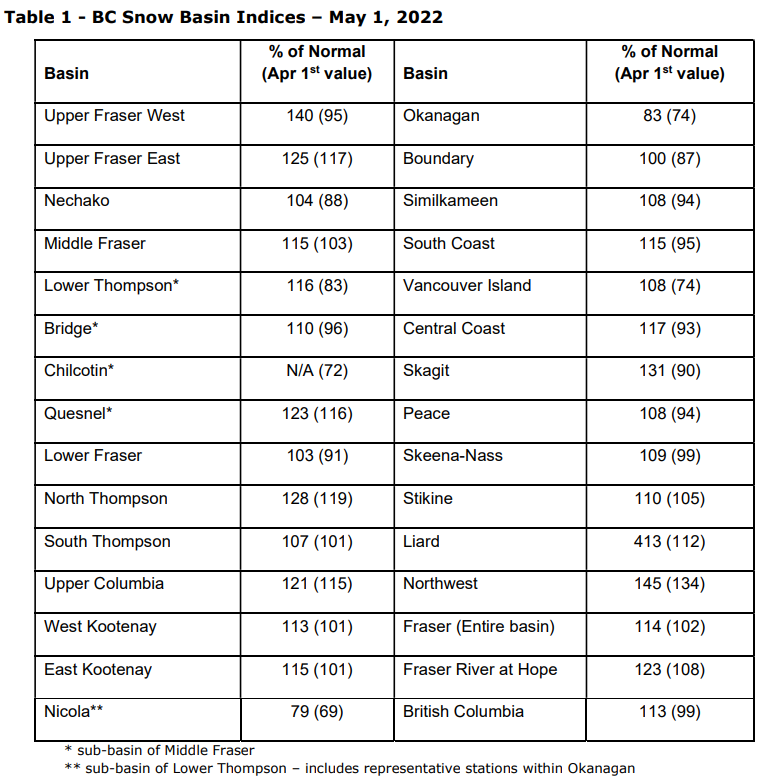
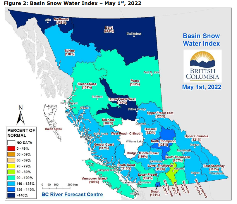
Cooler-than-average temperatures throughout April and into May have delayed the snowmelt, the report said, while the average snowpack across the province rose from 99 per cent of normal on April 1 to 113 per cent of normal on May 1.
“Continued cool weather in May is increasing the risk for major flooding if a prolonged heat wave occurs later in the month or June,” the report said.

Current conditions are comparable to historic flood seasons the province experienced in 1894 and 1948.

Get breaking National news
The centre urged communities to prepare, regardless of the current snowpack in the region.
“Every region is at risk for flooding, even if the snow pack is below normal,” its report said.
“The weather conditions in late May and June play a critical role in the rate at which the snow melts. For example, a gradual warming under dry conditions is ideal and would lessen the flood risk.”
However, a sudden heat wave or heavy rainfall event would speed up the rate of snow melt. A combination of the two could result in the worst-case scenario, especially if the high temperatures were as high as the 2021 heat dome.

For now, the forecast is showing no change in the current La Niña-influenced weather patterns. Cool, unsettled weather is expected for the next week.
Beyond that, conditions are impossible to predict with accuracy, the report said.
The Climate Prediction Center in the U.S. calls for a 59-per-cent chance La Nina conditions in B.C. will last into the summer, though that doesn’t mean a short period of extreme heat and/or heavy rain is out of the question.
The public is urged to stay tuned to the latest forecasts.


Comments
Want to discuss? Please read our Commenting Policy first.