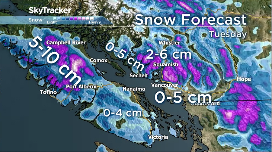
A rare April snowfall warning has now ended for B.C.‘s South Coast.

Some residents woke up to snow and flurries but the flakes are not expected to stick around.
The last time Vancouver recorded measurable snowfall in April was back in 2008, and, since records began in 1937, it has snowed in April in just 10 of those years.

Get daily National news
A cold, unstable airmass has been over the region for several days. Temperatures on Tuesday will be a good six to eight degrees below average for this time of year.
In addition, a low-pressure centre will cross the outside of Vancouver Island and act as a trigger for convection, which causes either thunderstorms or intense precipitation storm cells.
These intense storms will bring gusty winds, lightning, rain and hail to most parts of the south coast. Several centimetres of snow could also fall in a short period over a localized area.
The best chance of seeing snow will be over higher elevations and in northeast Metro Vancouver, where zero to five centimetres is possible.
Inland regions of the island and along the east coast from Comox to Campbell River could see five to 10 centimetres by Wednesday morning.
Due to the nature of convection, the precipitation will be highly variable from location to location, so residents are urged to be ready for anything.


Comments
Want to discuss? Please read our Commenting Policy first.