

A rare winter storm warning has been issued for parts of B.C.’s South Coast with snow and freezing rain expected to move through Wednesday and into Thursday.

Global BC meteorologist Mark Madryga said the storm will move to the B.C. coast Wednesday afternoon “with snow spreading onto Vancouver Island, and into the inner coast including Metro Vancouver early this evening.”
Read more: Rare winter storm watch issued for B.C.’s South Coast, could bring region to a ‘standstill’

The heaviest snow for the Lower Mainland will be late Wednesday evening and overnight, Madryga added.
“Milder air will race in quickly on Thursday morning with snow turning to rain,” he said.
“There is a high chance of freezing rain overnight on West Vancouver Island, and on East Vancouver Island and the Lower Mainland – especially the Fraser Valley – starting Thursday morning.”
Environment Canada is forecasting between 10 and 20 centimetres for Metro Vancouver and possibly up to 30 centimetres over Howe Sound and the Fraser Valley.
The organization said drivers should consider postponing non-essential travel until conditions improve as rapidly accumulating snow could make travel difficult over some locations.
The City of Abbotsford has issued a medium-alert level for residents due to the winter storm warning.

Get daily National news
The freezing rain could also fall on west and east Vancouver Island during the transition to rain. Non-essential travel should be avoided.

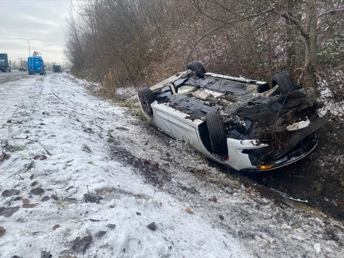
Some drivers were already having difficulty on the roads Wednesday.
A car rolled into a ditch on Highway 1 near the Sprott Street exit in Burnaby.
Witness Andrew Duckmanton told Global News the driver slipped on the snow, hit the brakes and then went sideways into the ditch and flipped over.
“I would say just a result of ice and snow on the ground,” he said.
“Make sure when you’re changing lanes, you change lanes nice and slow.”
Duckmanton said they stopped to make sure the driver was OK and not injured.


Mainroad Contracting said crews are preparing for this event by patrolling and pre-treating highways within the Lower Mainland service area.
Crews will also be on-site at the Port Mann and Alex Fraser bridges preparing for winter conditions and conducting winter maintenance activities, the organization said in a release. Lane closures will be in place and drivers are reminded to obey all traffic control signage, equipment and personnel.
The weather office warns mountain passes across Vancouver Island and throughout southern B.C. could see up to 40 centimetres, especially along Interior sections of Highways 1 and 3.
Most of B.C. is under weather warnings Wednesday with extreme cold, winter storm and snowfall warnings stretching from the Yukon border in the north to Vancouver Island in the south and all along the Alberta border.
Winter storm warnings are also in effect for the Interior with 10 to 25 centimetres forecast for all lower elevations. Non-essential travel should be avoided Wednesday evening through much of Thursday.

Following this heavy rain, the same storm will bring heavy rain to the South Coast.
Global BC meteorologist Kristi Gordon said between 30 and 70 millimetres of rain could fall across the Lower Mainland from noon Thursday to Friday morning.
Gordon said the combination of heavy rain and melting snow could cause localized flooding and pooling water on the roads.
Comments
Want to discuss? Please read our Commenting Policy first.