
Temperatures will reach the freezing mark on Thursday afternoon, but skies will clear and the mercury will plunge into negative double digits, with approximate lows of -9 to -12 C.

With the windchill, overnight temperatures could reach -13 C in the South Okanagan to -18 C in the Central and North Okanagan.
A mix of sun and cloud wrap up the week on Friday, with cool conditions keeping daytime highs around -5 C.

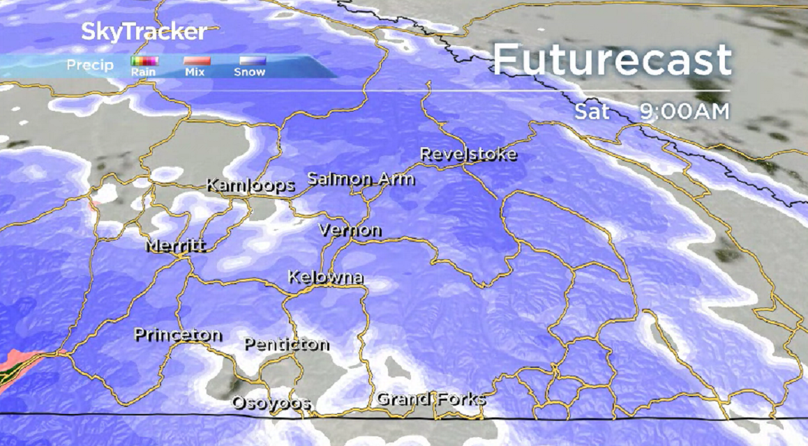
Steady snow returns Friday night and into Saturday, with five to 16 centimetres possible, as the mercury makes its way to just shy of the freezing mark in the afternoon.
Clouds will linger on Sunday, with a daytime high hovering around the freezing mark once again.
In the week before Christmas, conditions will see afternoon temperatures diving into the mid-minus single digits.


There will also be a risk of more light snow, meaning a white Christmas is on the way.

For weather on the go download the Global News SkyTracker Weather App for iPhone, iPad or Android.
- Posters promoting ‘Steal From Loblaws Day’ are circulating. How did we get here?
- Video shows Ontario police sharing Trudeau’s location with protester, investigation launched
- Canadian food banks are on the brink: ‘This is not a sustainable situation’
- Solar eclipse eye damage: More than 160 cases reported in Ontario, Quebec
Comments