The provincial government says it will continue to maintain water restrictions across B.C.’s Southern Interior as concerns about water supply grow with the continuing drought.

“Water scarcity remains an issue for most of the southern half of British Columbia even as cooler temperatures and rain have arrived,” said a release last week from the province’s river forecasters.
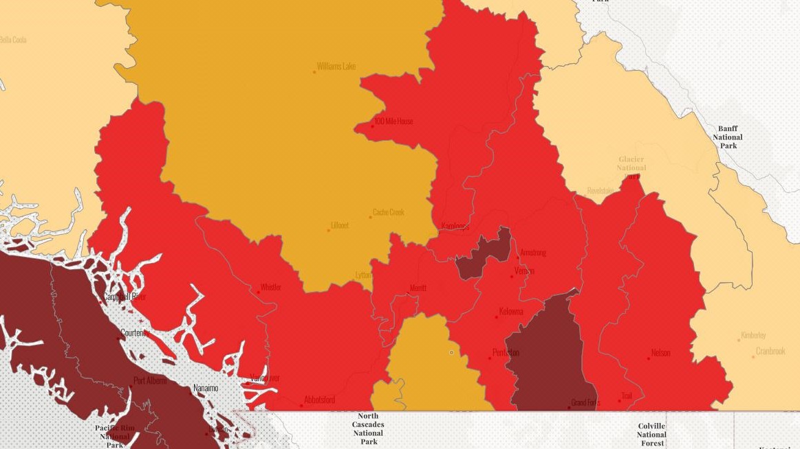
That has several local watersheds set at level 5, the highest drought rating. A seven-day average of the Lardeau River near Marblehead showed it at only 59 per cent of median flow.
Humphries Creek near Trout Lake and Anderson Creek in Nelson were also at the highest warning level. Anderson Creek is one of the water sources for the City of Nelson.
Overall, the West Kootenay is set at drought level 4. The drought level system ranges from level 0 to 5 in British Columbia. Drought level 5 is the most severe, with adverse impacts to socioeconomic or ecosystem values almost certain.
Other watersheds are not quite as hard hit. The Slocan, Kaslo, and Duncan Rivers, and Kuskanax Creek in Nakusp are all at level 2 drought conditions, with flow rates about 70-80 per cent of normal. Enough rain has fallen in the mid Slocan Valley that Lemon Creek is actually at 129 per cent of its median flow.

Get breaking National news
(That same rain has caused water quality issues on nearby Trozzo and Winlaw creeks, however, prompting a boil-water recommendation last week from a local environmental monitoring group.)
Water conservation levels at water systems run by the Regional District of Central Kootenay (RDCK) in Erickson and South Slocan were reduced from level 3 to level 2. Most other RDCK systems are also at that level.

Overall, the East Kootenay region has normal water levels due to recent rain. It’s just the opposite in the west, where the Kettle River system has been at the most extreme rating for weeks.
And it’s not expected to get much better soon.
“The dry conditions and water scarcity in the southwest Interior continue to intensify as precipitation systems are predicted to bypass these areas,” said an August 30 news release.
“The forecast slightly above-normal temperatures leading into the beginning of September will likely influence drought conditions as well.”
All water users in affected areas are asked to reduce their water use wherever possible and observe all watering restrictions from their local/regional government, water utility provider or irrigation district.
The drought has also prompted the closure of many popular freshwater angling rivers in the region, especially south of Hwy 3A.


Comments
Want to discuss? Please read our Commenting Policy first.