


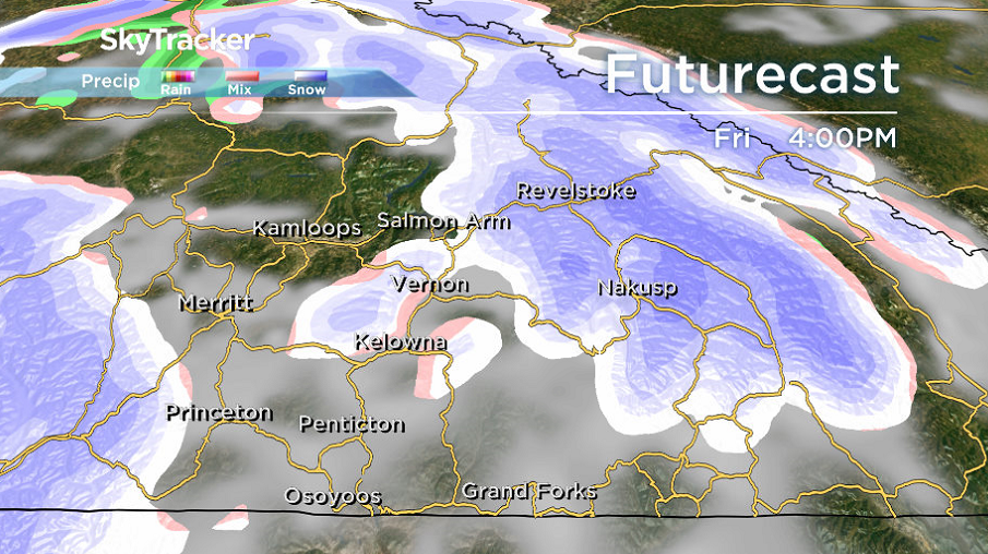
Following a cloudy start on Thursday, with pockets of precipitation pushing through the valley, sunny breaks will try to filter their way into the region to finish the day.

That should result in temperatures returning to double-digits.
However, the mercury will fall to the freezing mark in most areas on Thursday night as skies clear before another wave of clouds arrives Friday morning, along with a risk of rain and snow early in the day.

The potential for showers will linger into Friday as daytime highs climb toward double digits.
The second weekend of April will start on an unsettled note, with a risk of showers on Saturday as afternoon highs struggle to get into high single digits.

Get daily National news
Sunshine will return on Sunday, as an upper ridge builds in and boosts temperatures back into double-digits late in the day.
- Storm to bring up to 60 millimetres of rain to parts of Ontario, Quebec
- A ferocious Hurricane Simon nears Mexico with 155 mph winds and flooding fears
- Simon strengthens into a Category 4 hurricane as it approaches Mexico’s coast
- Isaias weakens but flash flooding threat persist as hundred of thousands grapple with power outages


Sunshine will stick around into the second week of April, with highs returning to the teens.

For weather on the go download the Global News SkyTracker Weather App for iPhone, iPad or Android.


Comments
Want to discuss? Please read our Commenting Policy first.