

Winter is finally here, whether you like it or not, and there are four chances for snow between now and the end of the weekend.

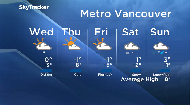
The first will move in from the north overnight Tuesday and bring light snow to parts of the South Coast Wednesday morning.
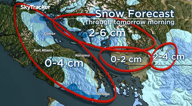
Metro Vancouver will likely see minimal amounts (zero to two cm) but it could fall during the morning commute, causing slippery roads and some minor delays.
Read more: 2020-2021 winter forecast: Here’s what weather Canadians can expect coast to coast to coast
The Sunshine Coast, Howe Sound and the North Shore Mountains could see two to six cm.
Meanwhile, the Fraser Valley and parts of south and east Vancouver Island could see anywhere from zero to four cm.
Late Wednesday morning and early afternoon, strong outflow winds will develop. During this time, brief but intense and localized snowfall could develop along sections of the east coast of Vancouver Island, Southern Gulf Islands and possibly parts of the Sunshine Coast.
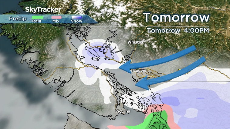
Outflow winds will likely be strongest late Wednesday into early Thursday, where wind gusts could reach 90 km/h in Howe Sound and wind chill values down to – 20 C in the Fraser Valley.
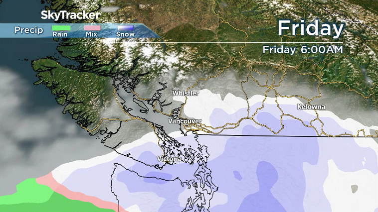
The second chance of snow will likely occur Thursday night into Friday morning as a system just clips our region. Stay tuned for details on this one since a small track a little further north could result in large amounts of snowfall for our region.
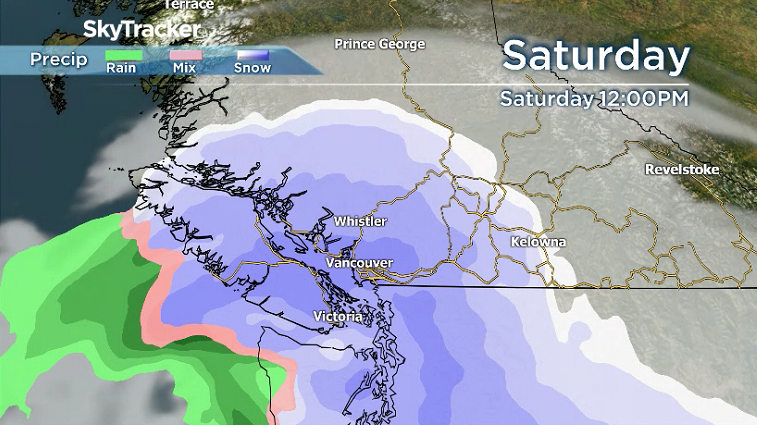
The third chance on Saturday will most likely be the biggest snow event for the Lower Mainland with widespread snow possible throughout the day. Pull out the toboggans, this could be a fun day!


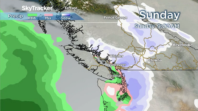
Then, on Sunday, we have a chance of snow in the morning but it will likely change to rain by the afternoon.
Keep in mind that all snow events across the South Coast can be tricky, so keep tuning back in throughout the week for updates.

Comments
Want to discuss? Please read our Commenting Policy first.