
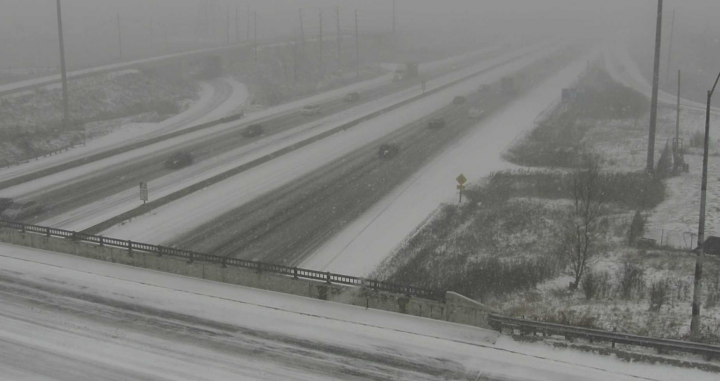
Weather advisories remain in effect for the Greater Toronto Area with some parts of the region expected to see up to 15 cm of snow Tuesday.

A storm moved in during the morning hours, bringing rapidly accumulating snow with it, and is expected to stick around until the evening.
Environment Canada has issued a snowfall warning for western portions of the GTA, including Mississauga, Brampton, Oakville, Burlington, Milton, and Halton Hills. Those areas are expected to see lake-enhanced snowfall, with totals near 15 cm.
“Winds near Lake Ontario are gusting to near 70 km/h which is causing significant blowing snow and reduced visibility,” Global News meteorologist Anthony Farnell said.
“Roads are already snow covered and very slick and that will continue to be the case through the afternoon.”
In areas not under a snowfall warning, winter weather travel advisories are in effect with a general 5 to 10 cm expected, according to Environment Canada.


Parts of Toronto and Caledon may see localized totals of 15 cm.
“We are on track to see more snow today than we’ve had the entire month of January so far in Toronto,” Farnell said.
“The snow will also be sticking around a while since temperatures are forecast to remain below freezing through at least the next week.”
Farnell said the “coldest air of the season” will move in Thursday and last through the weekend.
Comments