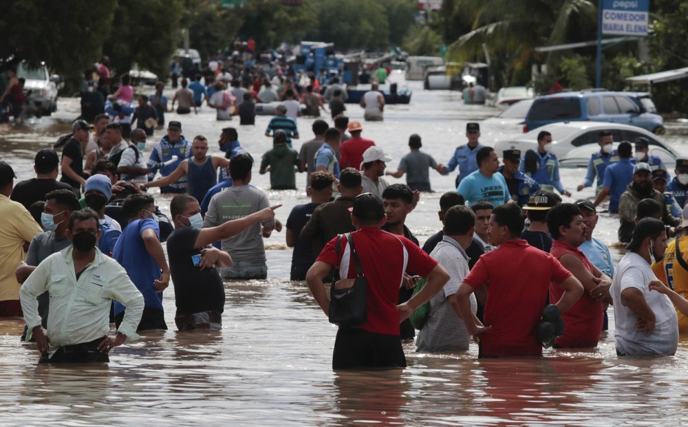
Tropical Storm Iota was strengthening in the Caribbean Sea on Saturday, threatening a second major hurricane strike for Nicaragua and Honduras, countries recently clobbered by a Category 4 Hurricane Eta.

The National Hurricane Center in Miami said Iota could bring dangerous wind, storm surge and as much as 30 inches (76 centimetres) of rainfall to the two Central American countries, reaching their coasts as early as Monday.
On Saturday night the storm was about 365 miles (590 kilometres) south of Kingston, Jamaica, and had maximum sustained winds of 70 mph (110 kph). Iota was moving to the west-southwest at 5 mph (7 kph) and is expected to strengthen quickly into a major hurricane as it approaches Central America.
The Caribbean island of Providencia and parts of Nicaragua and Honduras were under hurricane warnings.
Iota could wreak more havoc in a region where people are still grappling with the aftermath of Eta. That system hit Nicaragua last week as a Category 4 hurricane, killing at least 120 people as torrential rains brought flash floods and landslides to parts of Central America and Mexico. Then it meandered across Cuba, the Florida Keys and around the Gulf of Mexico before slogging ashore again near Cedar Key, Florida, and dashing across Florida and the Carolinas.

Iota is already a record-setting system, being the 30th named storm of this year’s extraordinarily busy Atlantic hurricane season. Such activity has focused attention on climate change, which scientists say is causing wetter, stronger and more destructive storms.

Get breaking National news
Eta was the 28th named storm of this year’s hurricane season, tying the 2005 record for named storms. Theta, the 29th, was weakening over the far eastern Atlantic Ocean. It was expected to become a remnant low by Sunday morning, forecasters said.
___
Frisaro reported from Fort Lauderdale, Florida.
- 3 in 10 Albertans would vote for independence — but only half committed to separating: poll
- China’s envoy says Beijing, Ottawa ‘eye to eye’ on supporting Greenland
- Intense cold forces flight delays, cancellations at Canadian airports
- Trump threatens 100 per cent tariffs on Canada over China trade ties


Comments