It’s a hot and humid start to a week that has already seen severe weather Monday morning in southwestern Manitoba. More could be on the way.

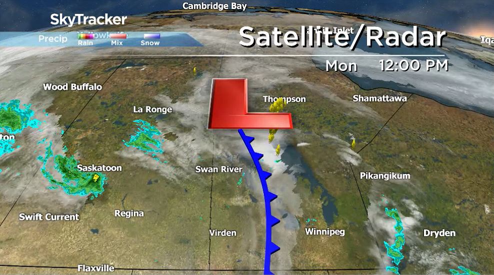
Monday morning, severe thunderstorms moved through southwestern Manitoba and into the Interlake. There were reports of significant hail in the Dauphin area.
Thunderstorm activity has been triggered by a cold front moving across southern Manitoba.
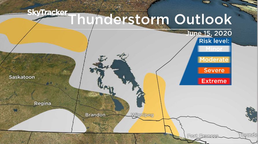
Around this low-pressure system, but more specifically along the cold front, more thunderstorm activity is possible, with large hail and strong winds being the greatest threats, according to Environment and Climate Change Canada.
This will not be the only opportunity to see shower activity with the risk of thunderstorms. Tuesday, more low pressure will move in from the south and keep conditions hot and humid. There is a chance heat warnings will be issued by Environment and Climate Change Canada as daytime highs and overnight temperatures are forecasted to be very close to the warnings criteria. There will again be a risk of severe weather on Tuesday, likely focusing more towards the southwest.

Get daily National news
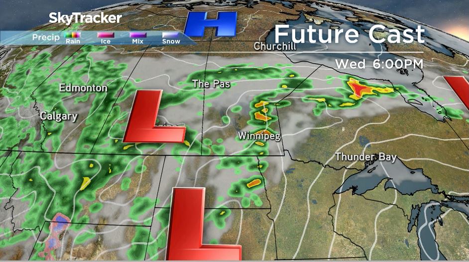
Wednesday’s conditions will be similar but appear to have potential for more rain activity around southern Manitoba. Weather models show higher rainfall totals for southeastern Manitoba, Winnipeg included, on Wednesday afternoon and Wednesday night.
Behind this round of precipitation, temperatures will cool off, with daytime highs closer to 20 C.


Comments
Want to discuss? Please read our Commenting Policy first.