
Temperatures soar into the high 20s or low 30s Friday, helping accelerate the melt of what is still a significant snow pack in many areas.

The last weekend of May kicks off with heat — temperatures are expected to reach the high 20s or low 30s, which will further accelerate the remaining mid- and high-elevation snowmelt.
This all takes place ahead of a low-pressure area that will bring back clouds on Saturday, with the chance of showers and thunderstorms in the evening.
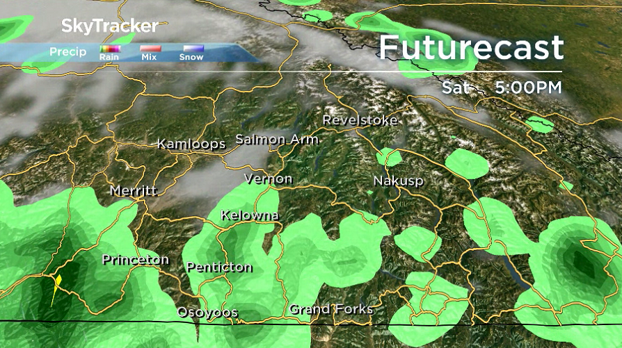
The system could bring in 10 to 35 millimetres of rain on Sunday that will fall in flood-prone areas during the day, raising the risk for more significant flooding into early next week.
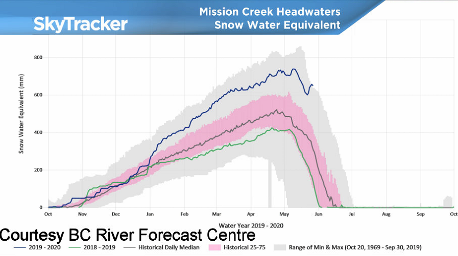
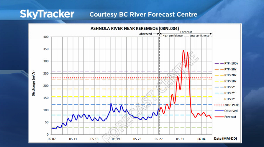
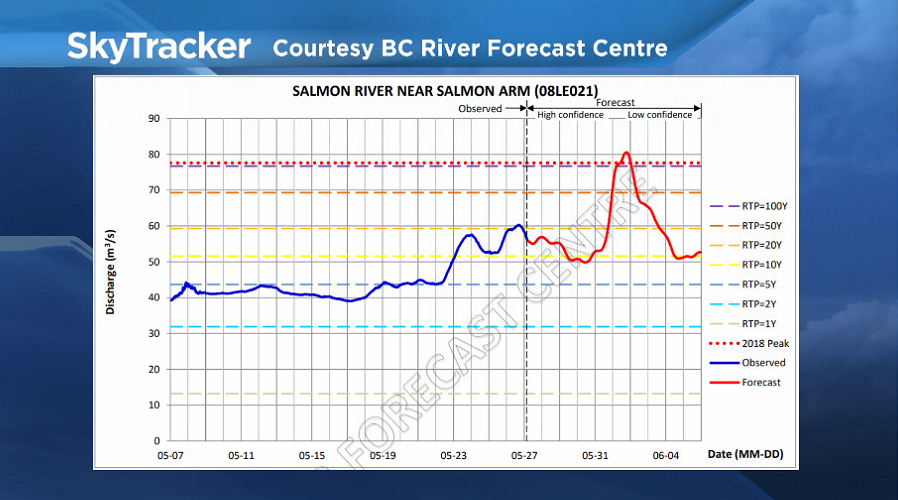
The B.C. River Forecast Centre is projecting the potential for significant flooding along Mission Creek in Kelowna, the Kettle River, Ashnola River and Salmon River if the anticipated rain falls as presently expected late Saturday and into Sunday.


Afternoon highs should scrape into the mid-teens on Sunday afternoon before returning to the low 20s with drier days into the first week of June.

For weather on the go download the Global News SkyTracker Weather App for iPhone, iPad or Android.
- Posters promoting ‘Steal From Loblaws Day’ are circulating. How did we get here?
- Canadian food banks are on the brink: ‘This is not a sustainable situation’
- Video shows Ontario police sharing Trudeau’s location with protester, investigation launched
- Solar eclipse eye damage: More than 160 cases reported in Ontario, Quebec
Comments