
Winter’s bark was worse than its bite for most of the country, and now, with days getting longer and normal temperatures quickly rising, we can look ahead to all the joys that spring brings in Canada.

A battle will set up through April with leftover Arctic air making frequent appearances, especially in the Prairies. An active storm track from the Great Lakes to Atlantic Canada will keep it wet especially in April.
We have not seen the last of the snow just about everywhere east of Victoria and Vancouver but when it does fall, don’t expect it to stick around for long.
The leftover April chill will be replaced by a warmer-than-normal pattern for most of the country later in May and early June.
WATCH: New flood management plan needed due to COVID-19

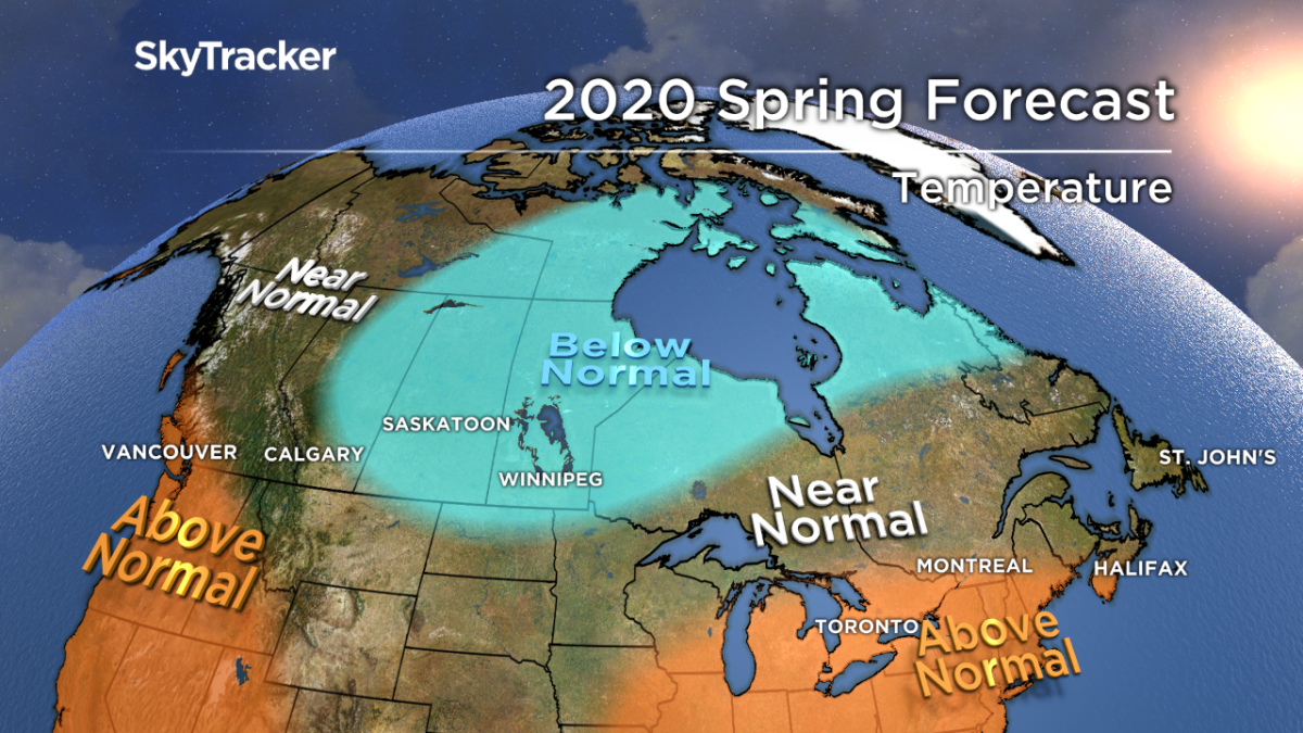
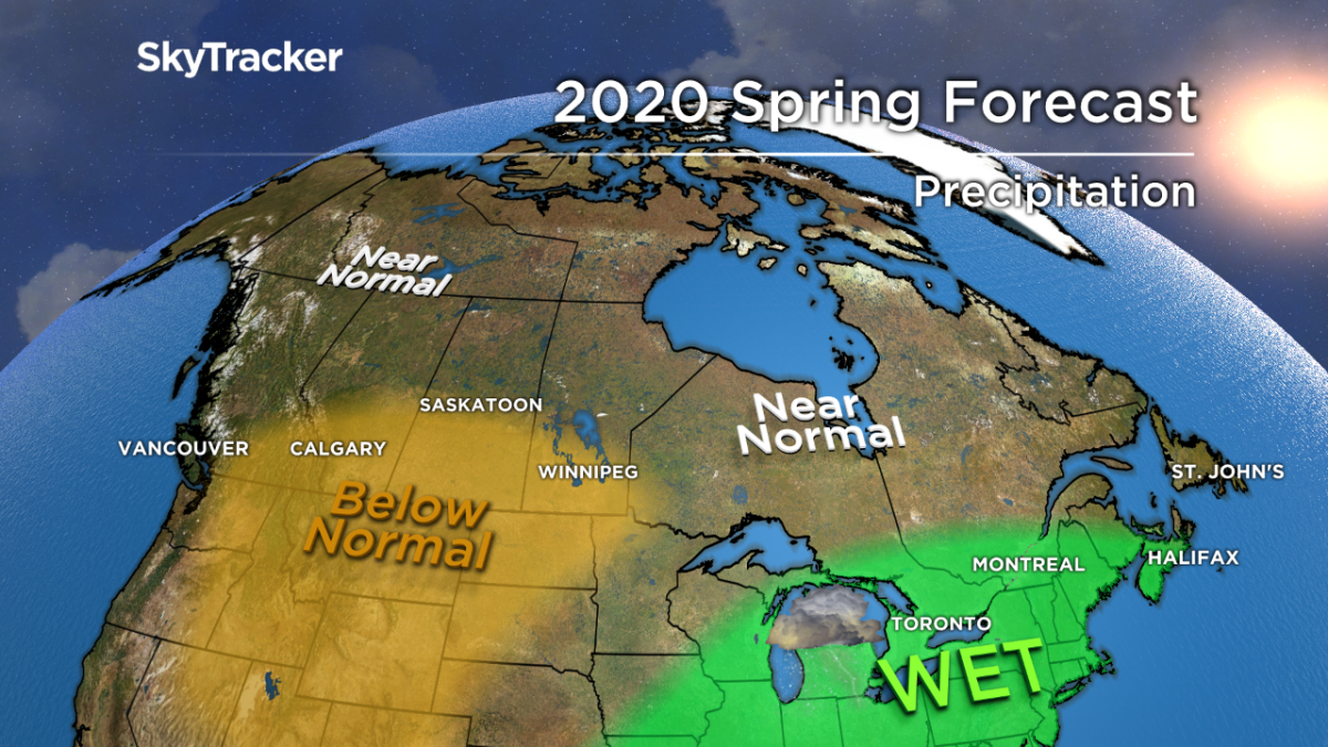
Here’s a detailed look at what to expect across Canada this spring.
Atlantic Canada
Slightly above-normal temperatures are expected across the southern part of Nova Scotia with the rest of Maritimes and Newfoundland coming in near normal this spring.
The “normal” spring will be from a combination of some very chilly April days followed by a milder pattern later in the season.
The storm track will impact the southern part of Atlantic Canada the most with above-normal snow and rain for most of New Brunswick and Nova Scotia.
Ontario and Quebec

Get breaking National news
A cooler-than-normal April is expected across most of Ontario and Quebec, which is a big deviation from the past few months.
The chill won’t last with a return to above seasonal air in May. The turn to mild air will be enough to offset the cool start to spring, which is why above-normal temperatures are forecast for southern Ontario and Quebec.
Much like last spring, an active storm track will lead to above-normal rainfall in areas that really don’t need it.
The Great Lakes are already running near record-high water levels, and a wet spring would mean another round of serious flooding for lakeshore communities.
This could also impact cities further downstream like Montreal as all that excess water flows down the St. Lawrence River.
READ MORE: Communities pleading for action to prevent further damage from Lake Ontario flooding
Prairie Provinces

Much of the extreme cold has been bottled up over the North Pole this winter, which has helped build more sea ice in that region.


Now that the polar vortex is weakening, the leftover Arctic air will be on the move south.
A piece of it will set up over the Prairies leading to a colder-than-normal first half of spring with the potential for more snowstorms, especially in Alberta.
Big swings in temperature are likely to continue through the first half of May before a prolonged warmer than normal pattern finally sets up.
Drier-than-normal weather will limit the flood threat in Manitoba. Alberta could still deal with some flooding as the above-normal mountain snowpack melts this spring.

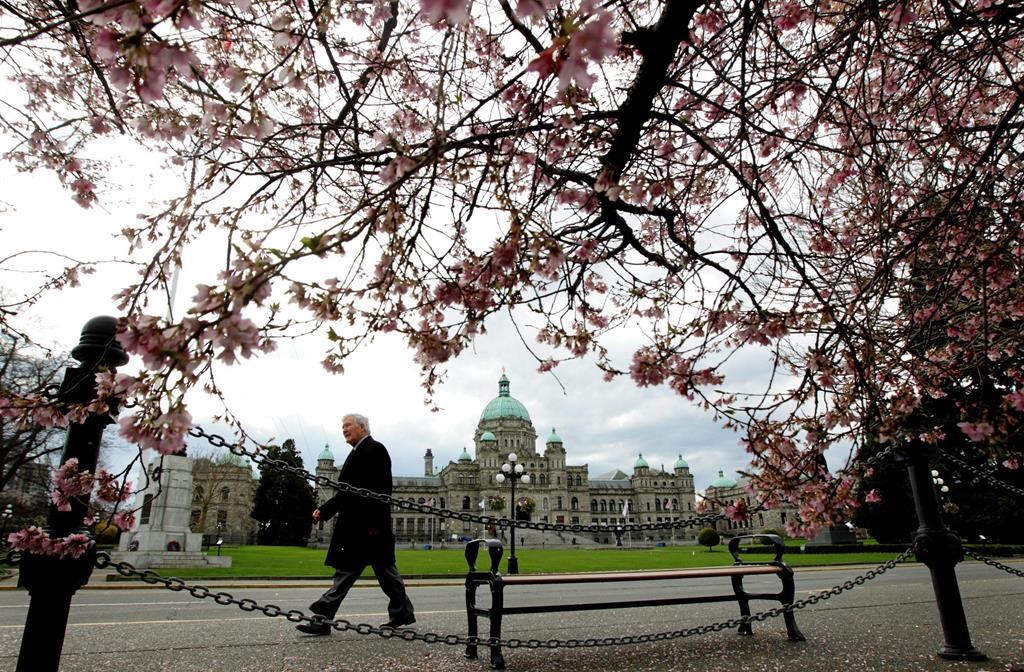
B.C.
Warmer-than-average temperatures will be confined to places like Victoria, Vancouver and the Fraser Valley while the rest of the province is close to normal.
There will be the usual swings in temperature that you’d expect in spring, but precipitation amounts should stay below normal for southern parts of the province.
This would be great news and go a long way preventing flooding as the snowpack is running well above normal up in the mountains.
Yukon, NWT and Nunavut
Below-normal temperatures will concentrate around Hudson Bay this spring, which should keep the ice locked in a little longer.
For areas further north and west, seasonal temperatures and precipitation are expected.
Comments
Want to discuss? Please read our Commenting Policy first.