Advertisement

Photo gallery: Calgary streets before and during the flood

Saddledome flooding in Calgary, 2013. Global News

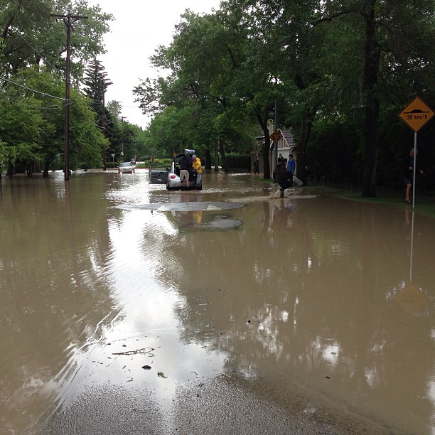
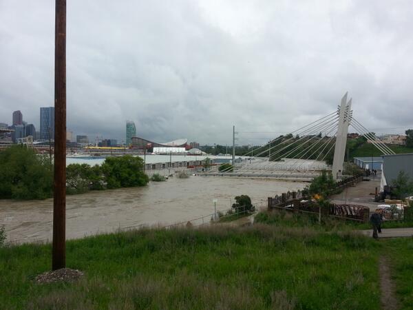
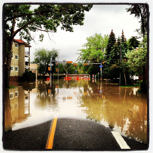
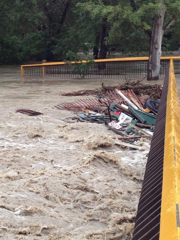
An estimated 75,000 Calgary residents have been evacuated from their homes as water washes through the city’s streets.

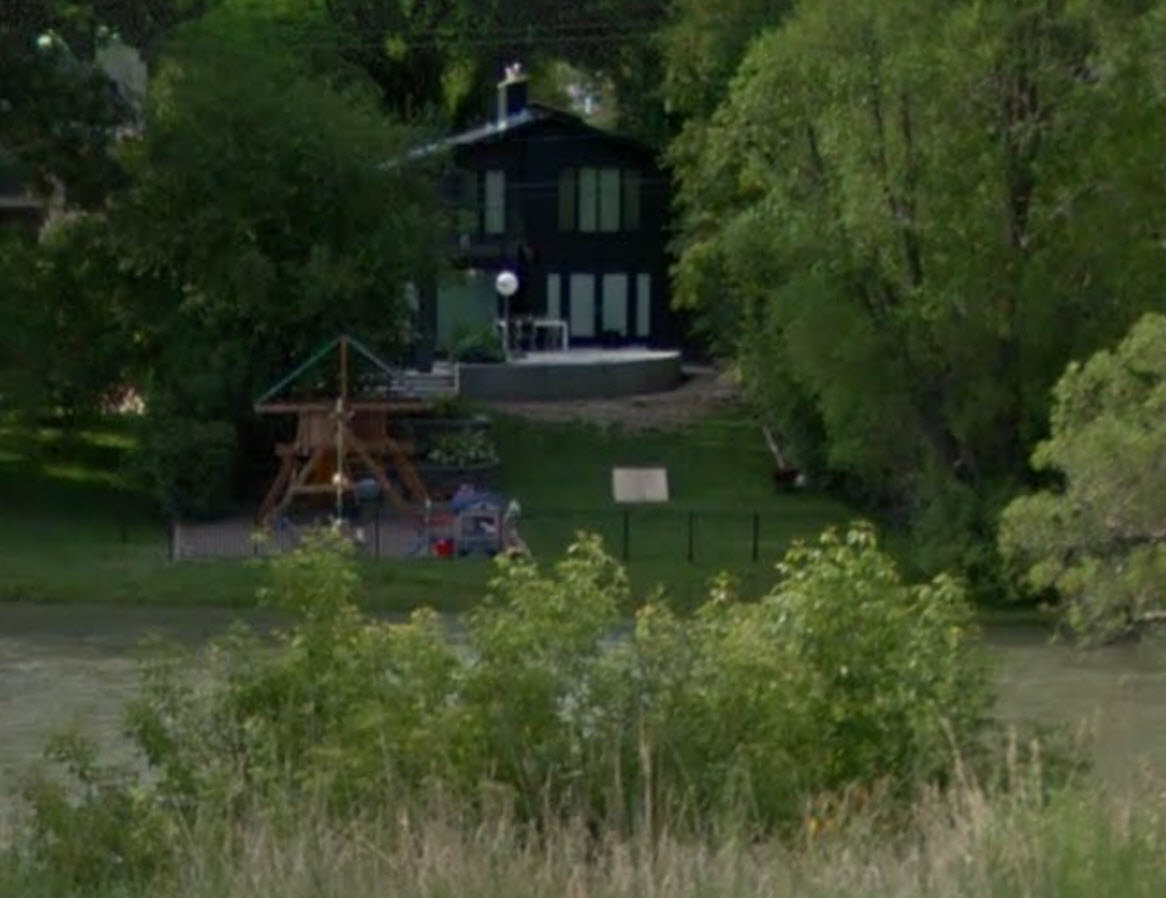
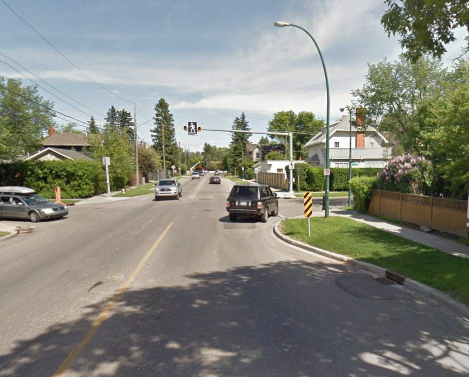
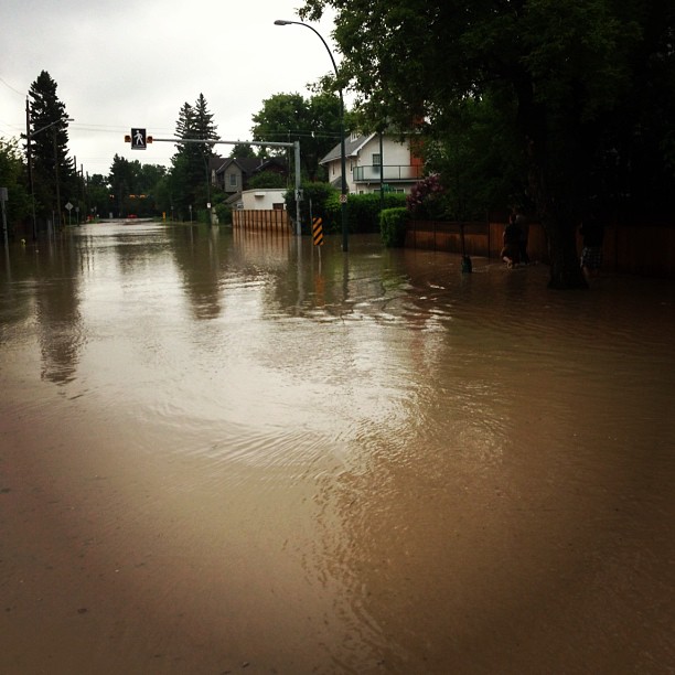
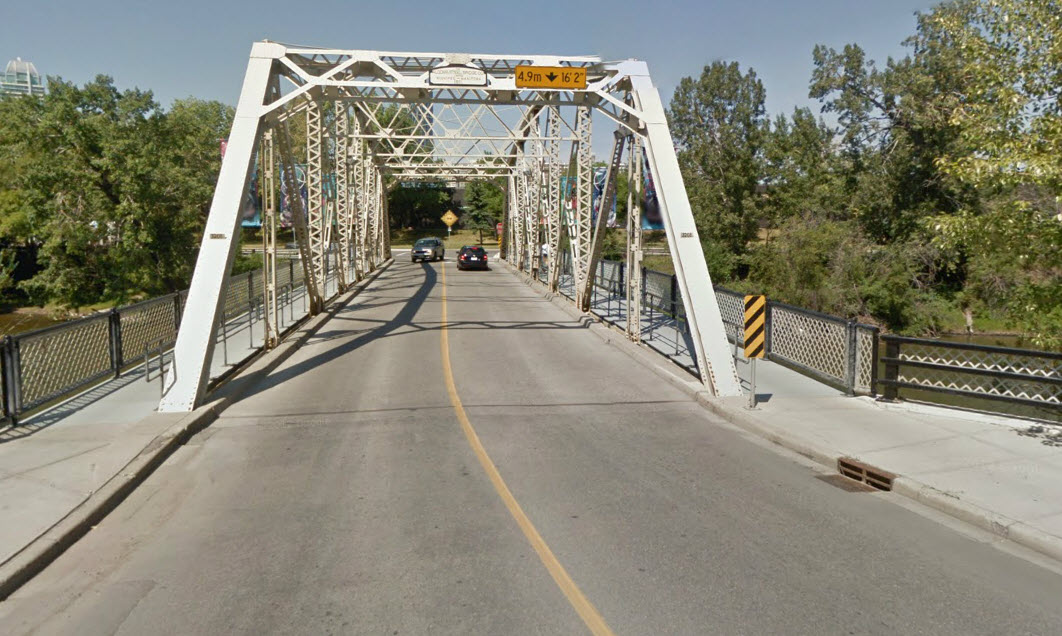
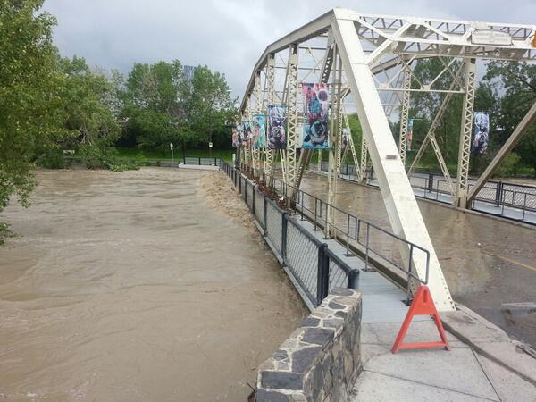
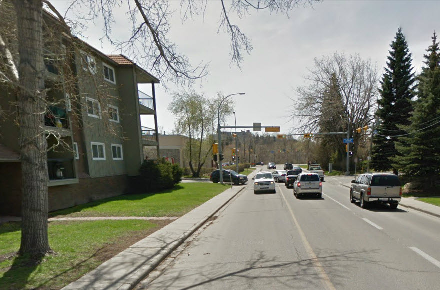
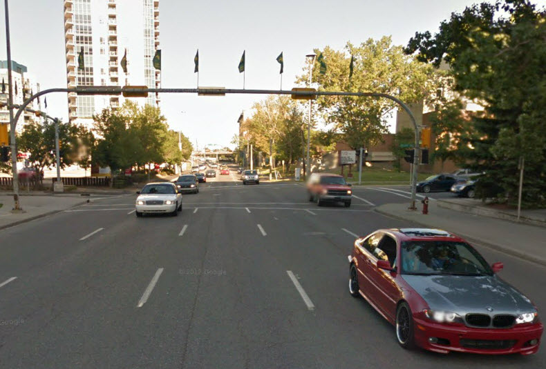
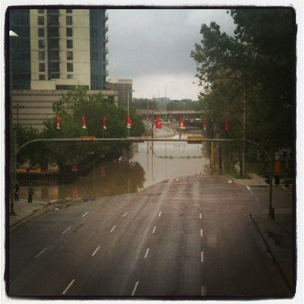
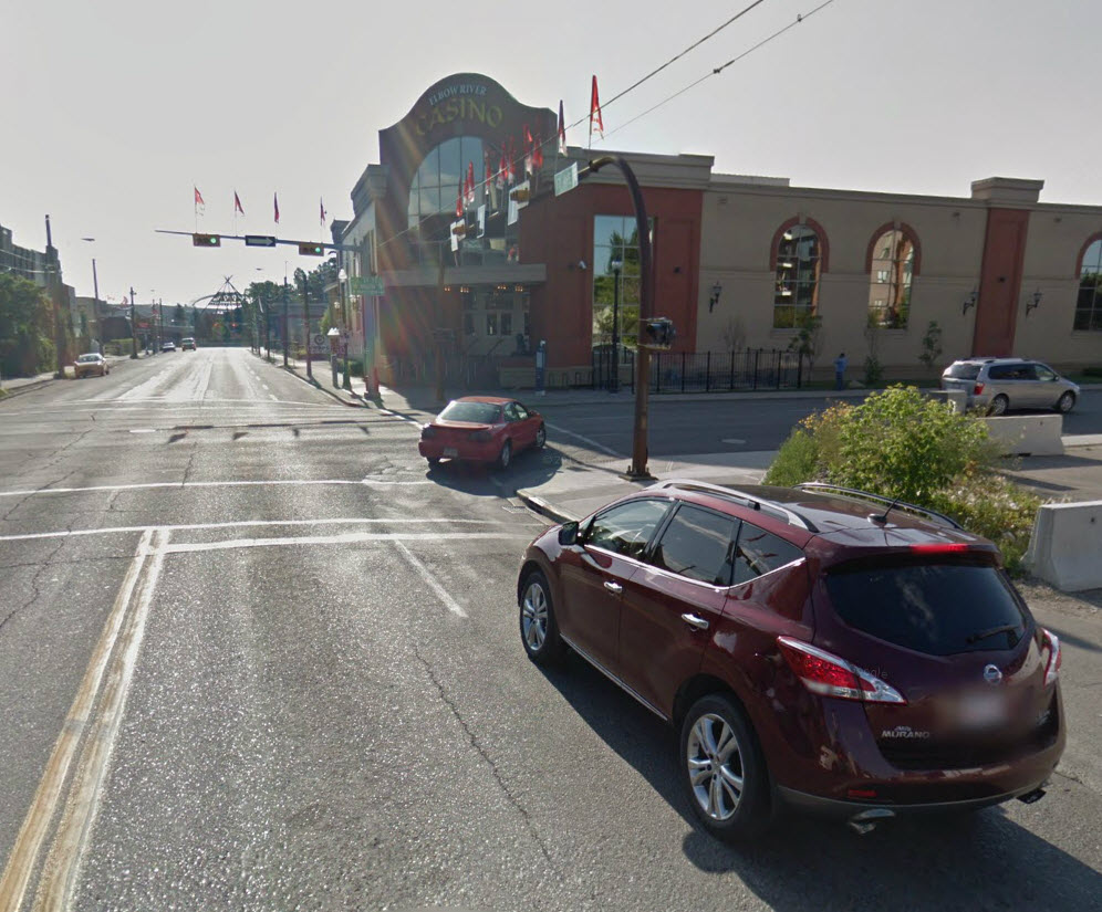
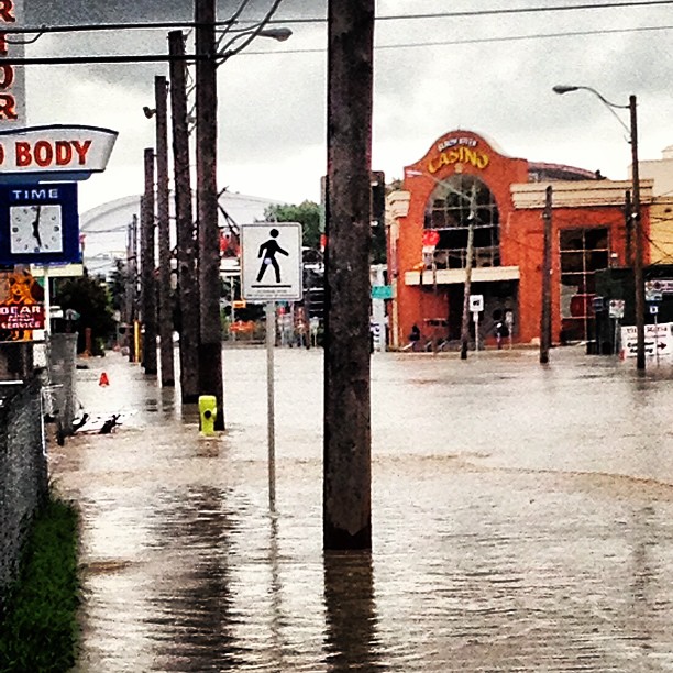
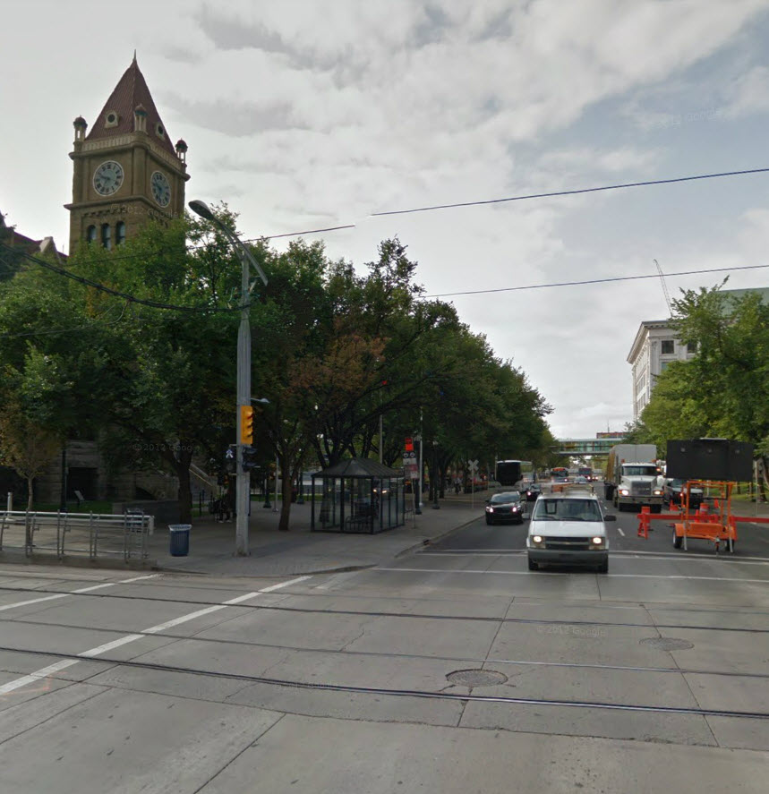
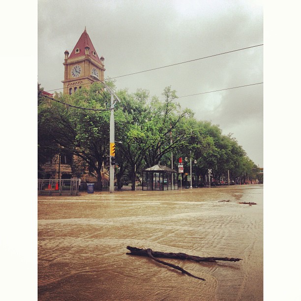
The photos below compare what parts of the city looked like before and after the flooding, using images from Google Street View and other more recent photos uploaded to social media by people in Calgary. Photos from social media may have been edited by users before uploading.

126
A street near Elbow Park in Calgary, before the flood. (Google Street View image). Google
226
A street in the riverside community of Elbow Park in southwest Calgary, June 2013. pjurisic / Instagram
326
A house backing onto the Elbow River in Calgary, before the flood. (Google Street View image). Google
426
The same house, with the backyard flooded, June 21, 2013. (Photo by zawalawhat / Instagram). zawalawhat / Instagram
526
A street near Elbow Park before the floods in Calgary. (Google Street View image). Google
626
The same street, flooded with water, June 21, 2013. (Photo by clovinski / Instagram). clovinski / Instagram
Story continues below advertisement
726
A view of the Stampede grounds before the flood. (Google Street View image). Google
826
The Stampede grounds during the flood. (Photo by scottwinograd / Twitter, uploaded June 21, 2013). scottwinograd / Twitter
926
The Macdonald Avenue bridge over the Elbow River, before the flood. (Google Street View image). Google
1026
The Macdonald Avenue bridge during the flood. (Photo by scottwinograd / Twitter, uploaded June 21, 2013). scottwinograd / Twitter
1126
A before shot near 5th Street and 24 Ave SW in the Mission. (Google Street View image). Google
1226
The same intersection during the flood, June 21, 2013. (Photo by fergiepopz / Instagram). fergiepopz / Instagram
Story continues below advertisement
1326
A bridge in Lindsay Park before the flood. (Google Street View image). Google
1426
The same bridge during the flood. Debris has built up along the side. Photo uploaded June 21, 2013. (Photo by CameraguyRob / Twitter). CameraguyRob / Twitter
1526
Google street view along Macleod Trail SE, near 4th Ave. (Google Street View image). Google
1626
The same area after the flooding, June 21, 2013. (Photo by jonporter1 / Instagram). jonporter1 / Instagram
1726
The Elbow River Casino in Calgary, before the flooding. (Image from Google Street View). Google
1826
The Elbow River Casino after the flooding on June 21, 2013. valleysvalleys / Instagram
Story continues below advertisement
1926
The clock tower at Old City Hall in Calgary. (Image from Google Street View). Google
2026
The street outside the clock tower flooded on June 21, 2013. (Photo by peterloliver / Instagram). City Hall clock tower during flood
2126
Aerial image of the Centre Street Bridge from Google Earth.
2226
Centre Street Bridge seen from the air Friday (Global News).
2326
Aerial image of the area around city hall from Google Earth.
2426
Area around city hall seen from the air Friday. (Global News).
Story continues below advertisement
2526
Aerial image of the Saddledome from Google Earth.
2626
Area around the Saddledome seen from the air Friday (Global News).

Sponsored content

AdChoices