
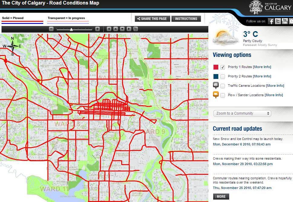
CALGARY – The city has launched a new website that will allow Calgarians to see whether streets in their community have been ploughed, and if not, when they will be.
The newly developed road conditions map shows real-time results of Calgary’s major roads that have been plowed or are being plowed.
Users can also see which routes City sanders and plows are currently working on with links to traffic cameras in the area. A drop-down menu of all city communities is available so a user may zoom to their specific location.
During and after storms, the map will also feature live updates about the work being done.
“This will be an awesome tool for commuters, the media and citizens,” said Sean Somers, with the City of Calgary’s Transportation department in a press release. “We’ve heard time and time again about folks not seeing our equipment out there during big storms. Not only will you be able to see our equipment, you’ll be able to track our progress, and plan your commute based on where we’ve been,” he added.
Calgarians can find the map at Calgary.ca/roadconditions.

Comments
Want to discuss? Please read our Commenting Policy first.