
30-degree heat slides out with a cold front and thunderstorms.

Weather forecast
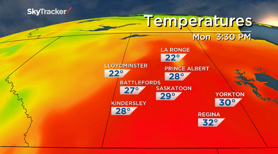
Monday
30 degree heat slides into Saskatchewan one more time this summer with the mercury beginning the day in low double digits, but making it up into the mid-20s before noon.
Mostly sunny skies stick around across the province under an upper ridge of high pressure, which will help boost temperatures into the low 30s, which will feel a few degrees warmer with humidity.
Monday night
Clouds roll back in across the region Monday night as a system pushes into the province and conditions cool back into low double digits overnight.
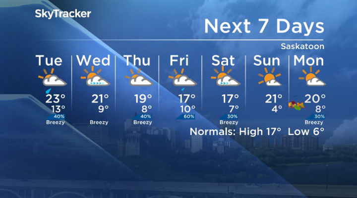
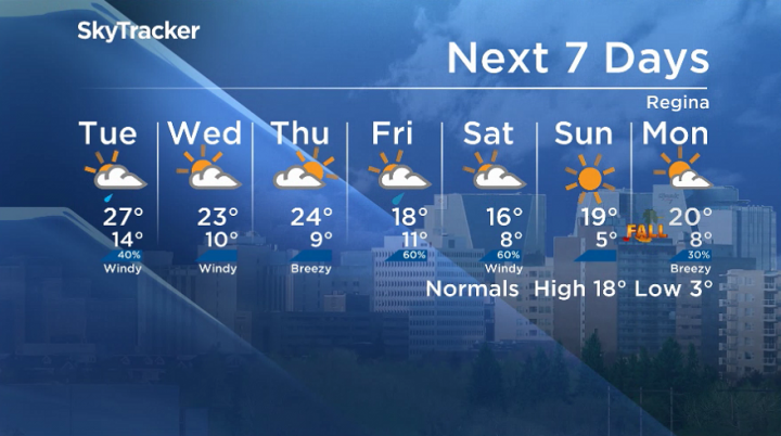
Tuesday
The low pressure system will keep clouds around the region on Tuesday with a chance of showers and risk of a thunderstorm midday as a cold front kicks up northwesterly winds with gusts upwards of 50 km/h.

Get breaking National news
Temperatures should manage to make it into the mid-20s for an afternoon high before more intense and potentially severe storms filter through Tuesday evening.

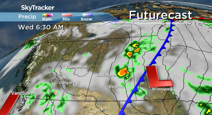
Wednesday-Friday
Skies clear back out on Wednesday before the next system with clouds and a chance of showers slides in on Thursday and Friday.
Daytime highs will fall from the low-to-mid 20s on Wednesday to the high teens by the end of the week.
Weekend outlook


Rain is likely to linger on Saturday as an upper-level low-pressure system joins into the surface system before sunshine returns on Sunday as daytime highs linger in the teens.
The Your Saskatchewan photo for September 16 was taken by Bonnie Redekopp at Turtle Lake:

The Saskatchewan weather outlook is your source for the province’s most accurate forecast and is your one-stop-shop for all things weather with comprehensive, in-depth analysis that you can only find here.
For weather on the go download the Global News SkyTracker Weather App for iPhone, iPad or Android.
Comments
Want to discuss? Please read our Commenting Policy first.