

Hundreds of upset and confused residents packed a Pointe-Claire hotel convention centre Thursday night to get answers during public consultations held after the province released its updated flood zone map.

“It’s very arbitrary,” said David Mapp, a Dorval resident.
“It feels like they didn’t respect the contour lines. Our shoreline is definitely a lot further from our house and it doesn’t make any sense, really.”
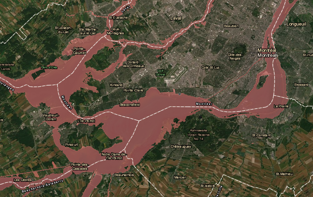
The map now puts 813 municipalities and thousands of homes in flood zones.
The flood zone areas are now called special intervention zones (ZIS).
Along with the release of the maps, the government also imposed a building moratorium on the following cases:
- People who are in a zero- to 20-year flood zone or an area that has a one in 20 chance of being flooded every year;
- People who were flooded in 2017 and 2019;
- Flood victims whose homes have been damaged 50 per cent or more;
- New construction
Several West Island mayors are speaking out against the new maps.

Get breaking National news
“Nowhere have I heard in the last number of weeks any initiatives by the government that would help the municipalities build the proper infrastructure and assist us to protect the homes that are there,” said Pierrefonds mayor Jim Beis.
Many areas that now appear on the map as special intervention zones, Beis added, have never been flooded or are even at risk.
- Kraft Hockeyville-winning town of Taber reopens ice rink after 2025 explosion
- Possible WestJet strike has Kelowna travellers worried about their plans
- Possible WestJet strike leaves dog competitor out thousands in rebooking fees
- Saskatchewan First Nation worried about community safety after vet clinic cancelled


Several Pointe-Claire properties in the same situation have already been removed from the new flood-risk zone.
But Beis fears homes will lose value, even if they are removed from the zone.
“Will insurance companies now insure the homes and the businesses that lie within this zone? Will the real estate market change, will people be able to sell their homes for the value that they’re worth?” Beis said.
The government says these flood zone maps have been drafted in order to protect people from more flooding, but several people at the meeting didn’t understand how these maps would do so.
“Basically you’re not getting a lot of answers here tonight,” said Mark Datko, a Pierrefonds resident. “It’s very disappointing.”
Officials representing the province said they will take all comments and concerns into consideration and will review their drafts accordingly.
They say they will adopt their updated drafts on July 15.
People and municipalities can submit their briefs on the issue to the Quebec ministry of Municipal Affairs until Aug.19 via email zis2019@mamh.gouv.qc.ca.
WATCH: Quick action by soldiers and municipal workers averts flooding disaster in Pierrefonds

Comments
Want to discuss? Please read our Commenting Policy first.